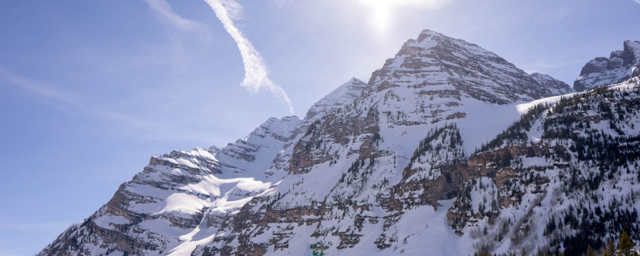
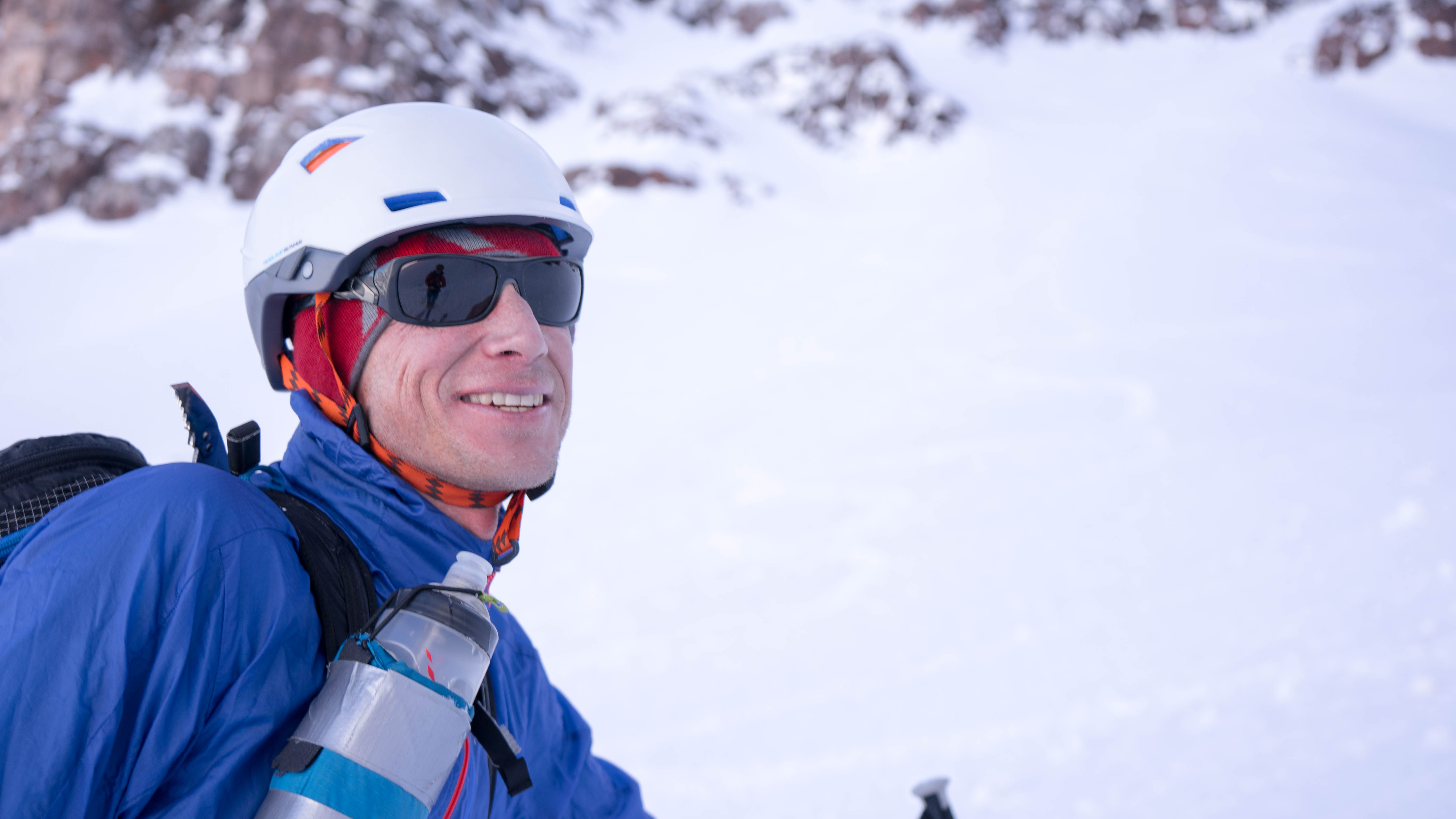
Partners, Jason Kilgore, Chris Baldwin and I were able to seize the great weather and prime snow conditions this Saturday the 18th. Skiing Maroon Bells, Bell Cord and North Face in winter, in a day from Breckenridge, starting at the T Lazy 7 trail head was, well, AWESOME! And obviously we named it the ‘Double Bells Day!’
We made complete ski descents of both the Bell Cord Couloir 3937′ from the summit of Maroon Peak 14,156′ and the classic North Face 3858′ of North Maroon Peak 14,014′ to the lake. We got a little conditions report help from Zach Guy and Chris Miller as they had made a descent of the South West face of Thunder a couple days prior. It’s always fun to be able to forecast conditions and open a line for the season!
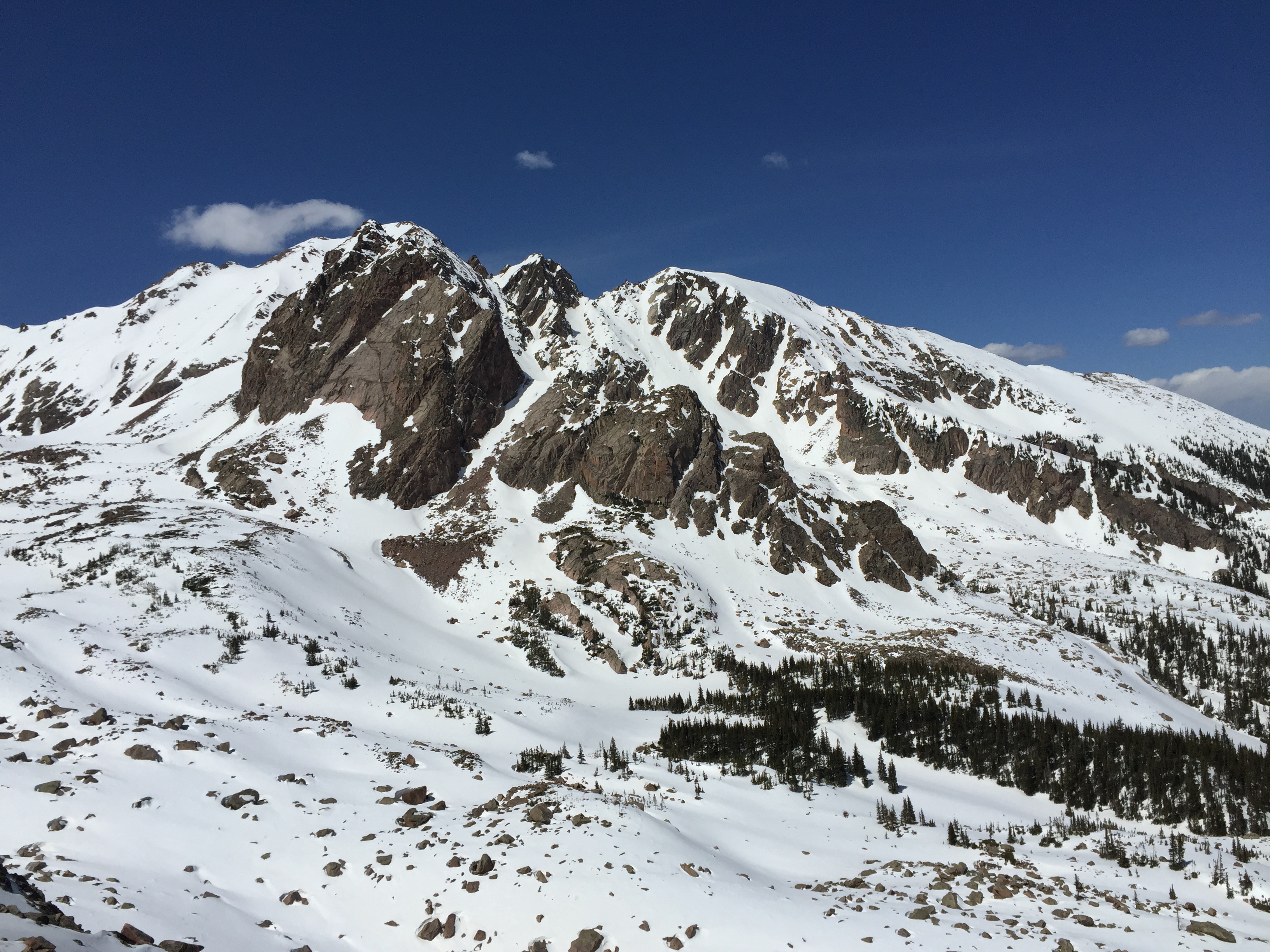
The Bells hold classic ski lines on all three, and they are in the neighborhood of 4000’ long. So to enchain even more than one is a committing tour and means a minimum of almost 9000’ of skiing. Even if one chooses to take a snowmobile in.
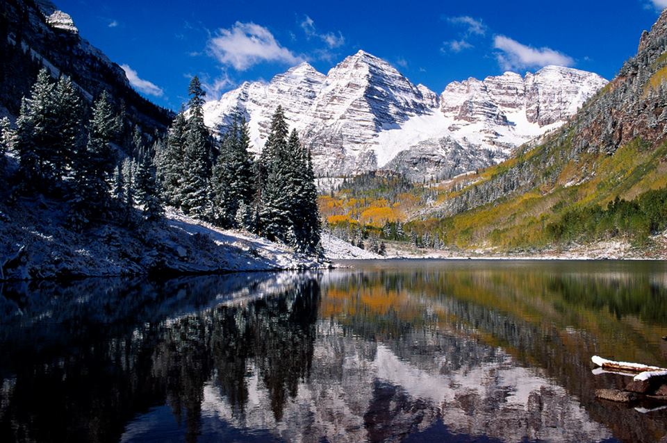
Autumn Photo from FB
Jason and I have bumbled round the hills long enough, always seeking to learn how to move quickly in the backcountry with out always being in a rush. So the extra 6.5 mile approach from T Lazy 7 with out a sled isn’t so bad. I think it’s actually easier and probably takes less time than maintaining, fueling and trailering a snowmobile. When it’s warm in the spring I guess having to stop to shovel snow on the engine sounds like it takes around an hr to get in to Maroon Lake anyway. It takes us 1:30. So not a big trade off really. Now don’t get me wrong! If I lived in Aspen I would have a sled. It just makes sense if you live there. But we don’t. And sometimes the simpler we make things, the richer the experience.
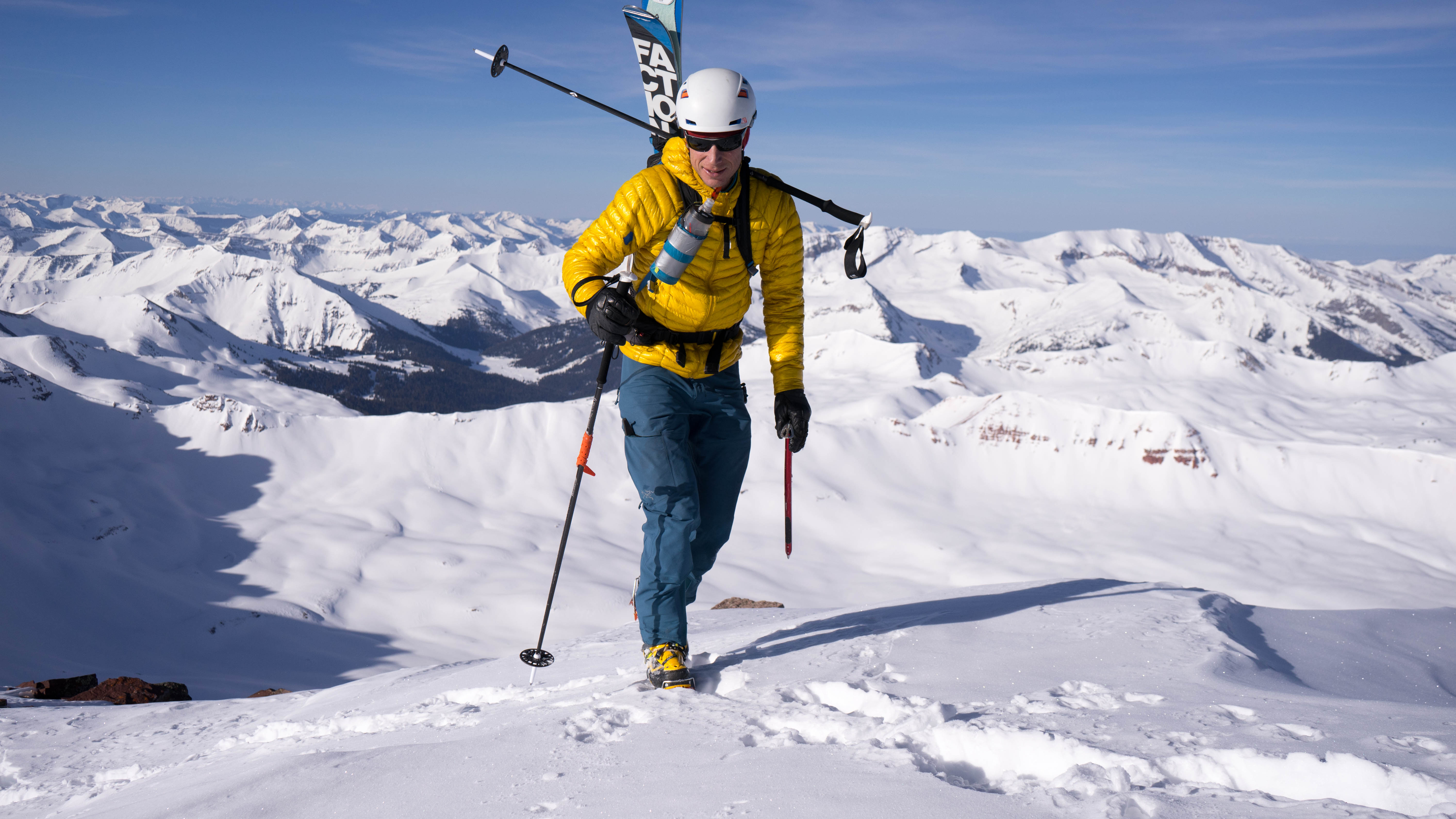
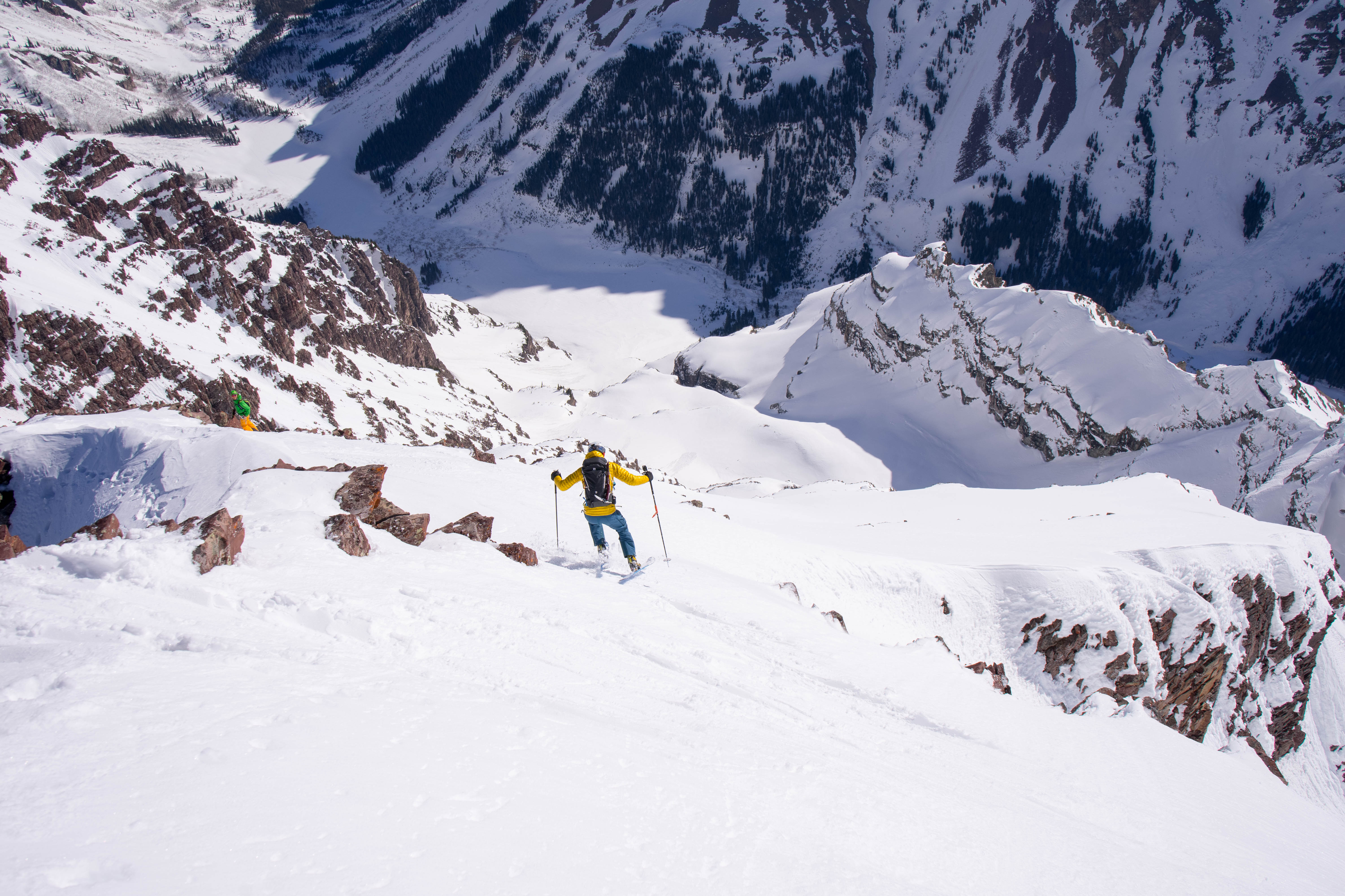
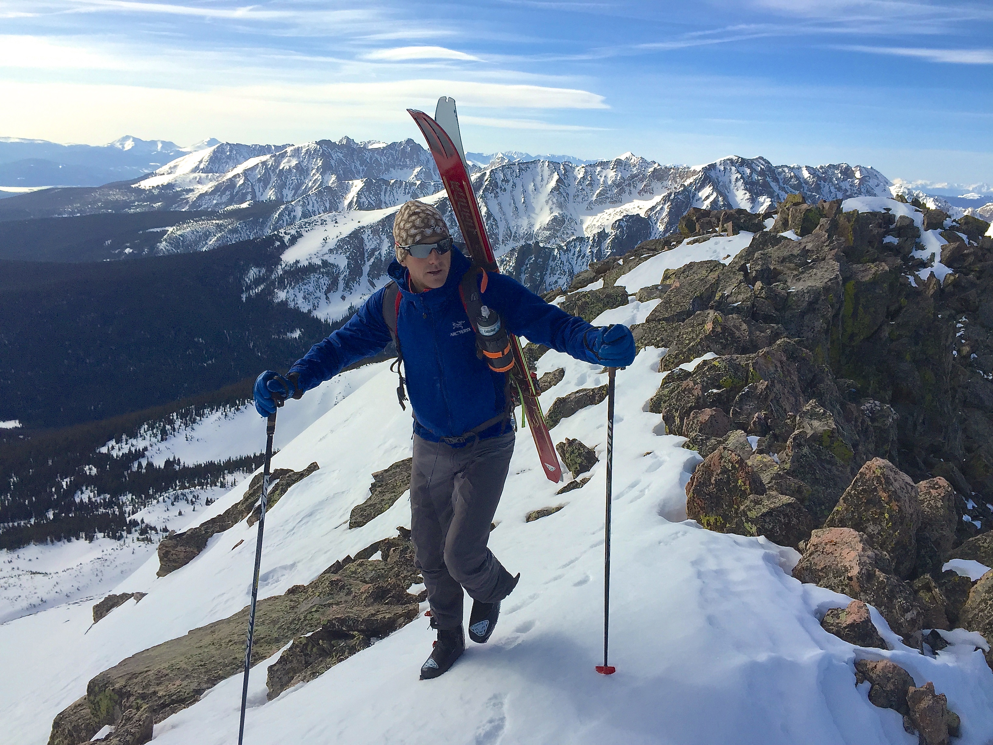
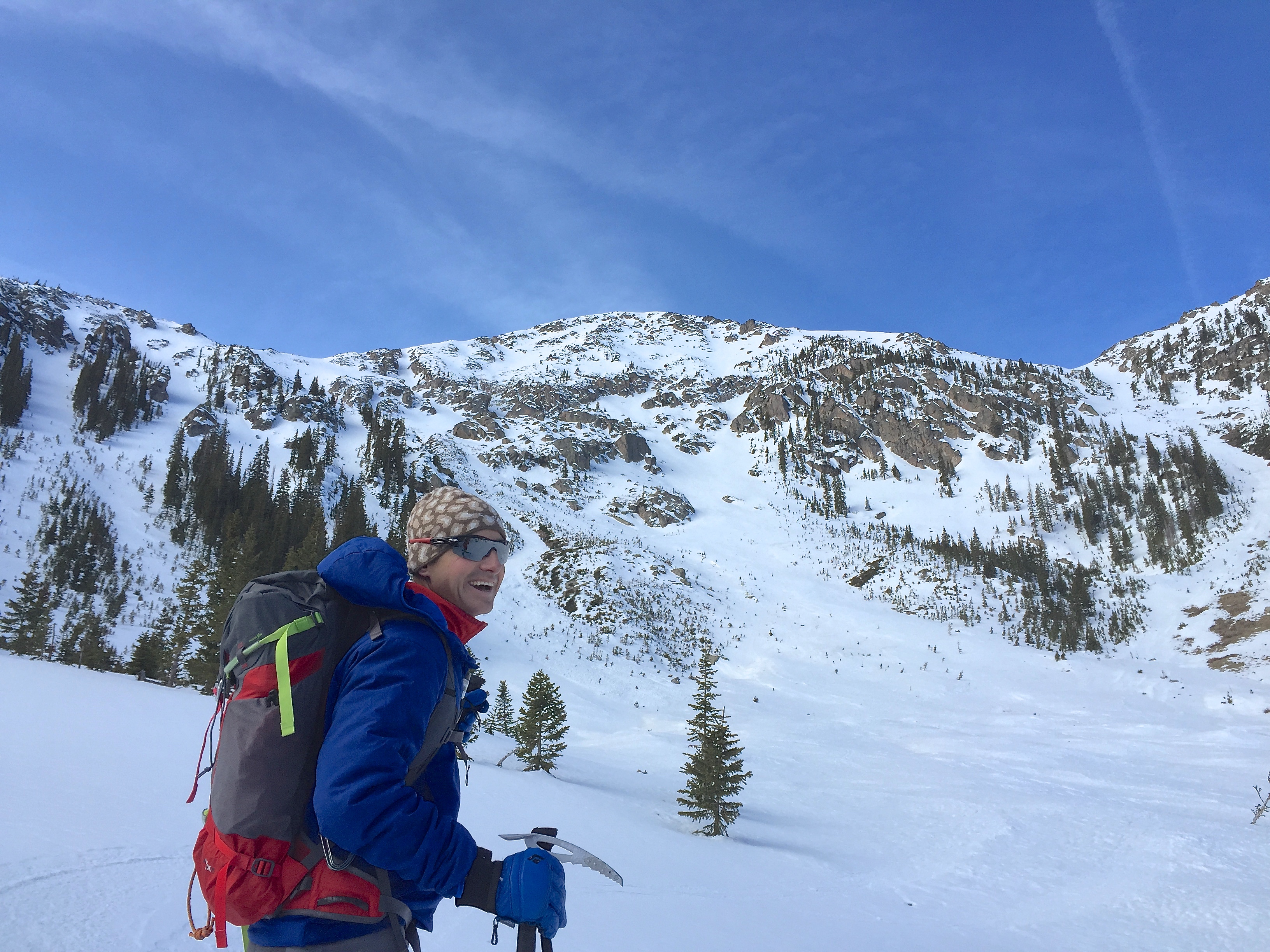
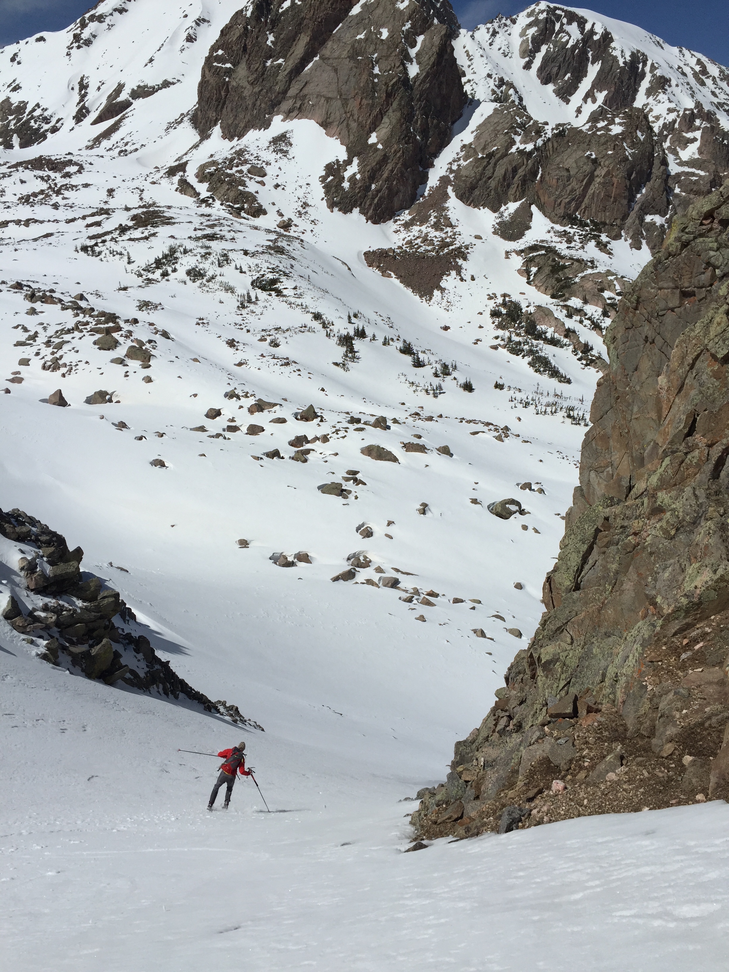
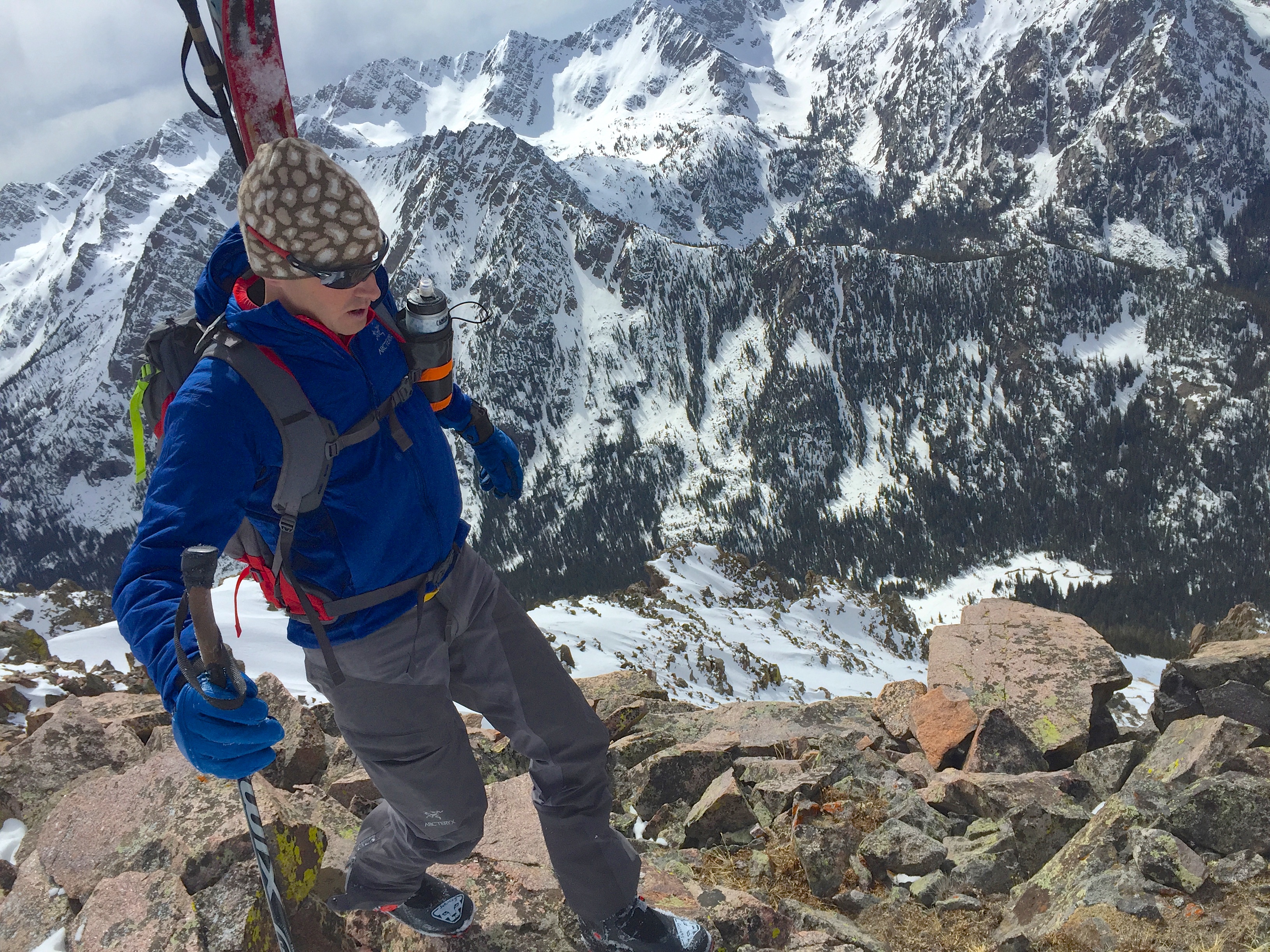
The road was refrozen and fast so we skated in about 7k from T-Lazy 7 trail head, then skins on for the last couple miles. We left the trail head at 3:30 am and were on the summit of Maroon Peak at 8:30am including time to asses conditions, discuss options and take in the views along the way. Keeping a reasonable pace on the way in and up the first climb was key to making rest of the day enjoyable!
…yeah pace is the trick… -Interpol
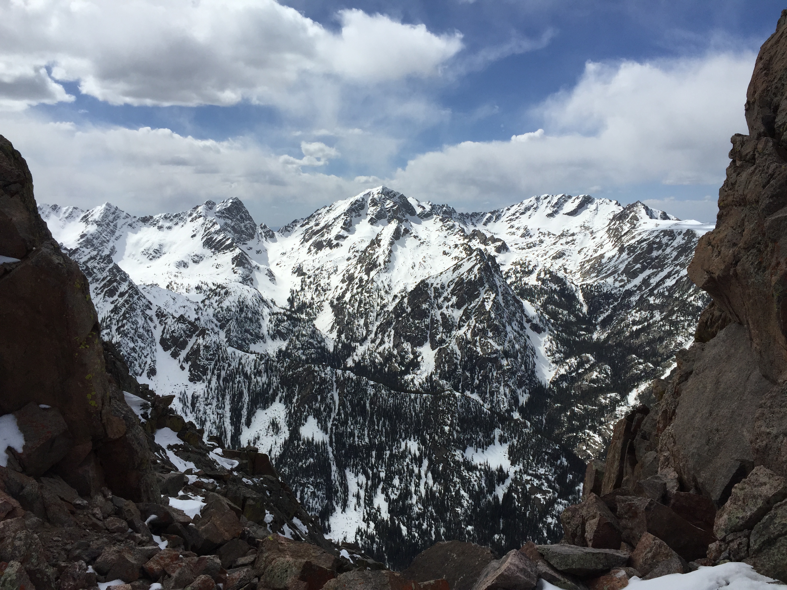
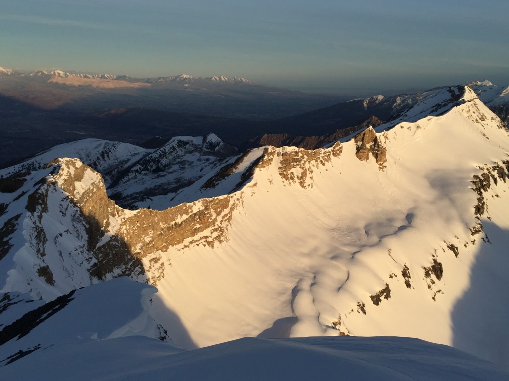
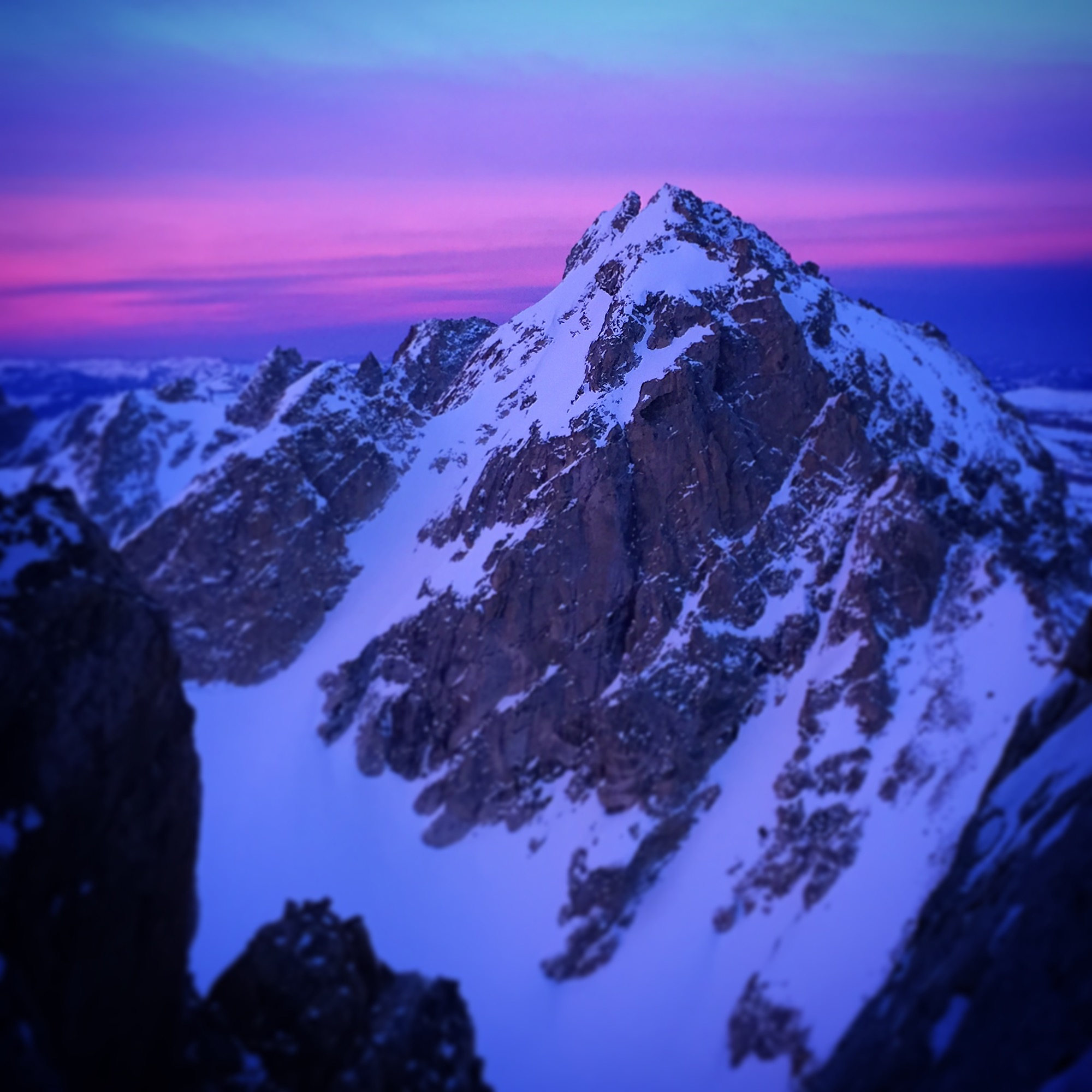
The “Paradise Divide” and Crested Butte beyond.
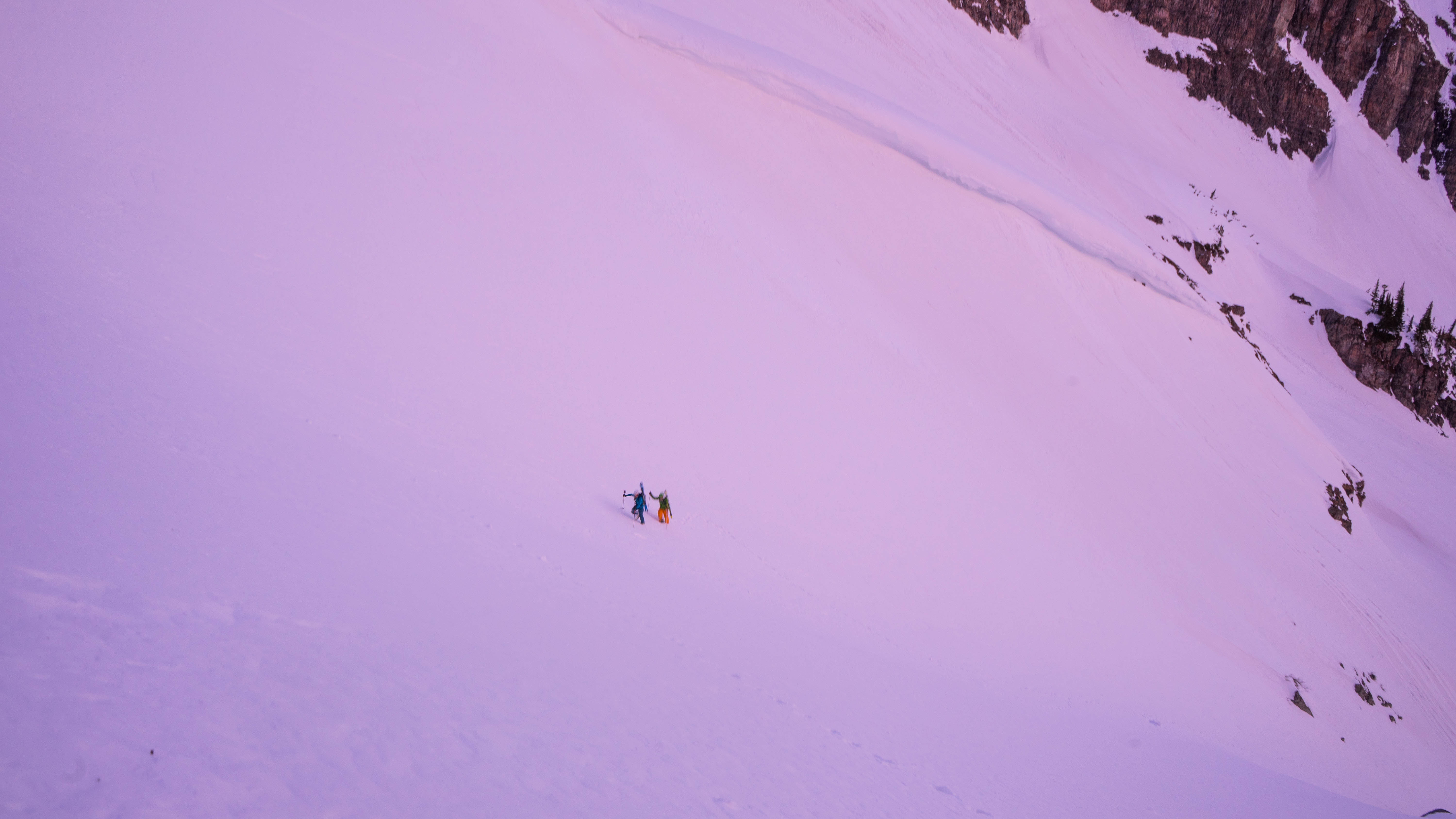
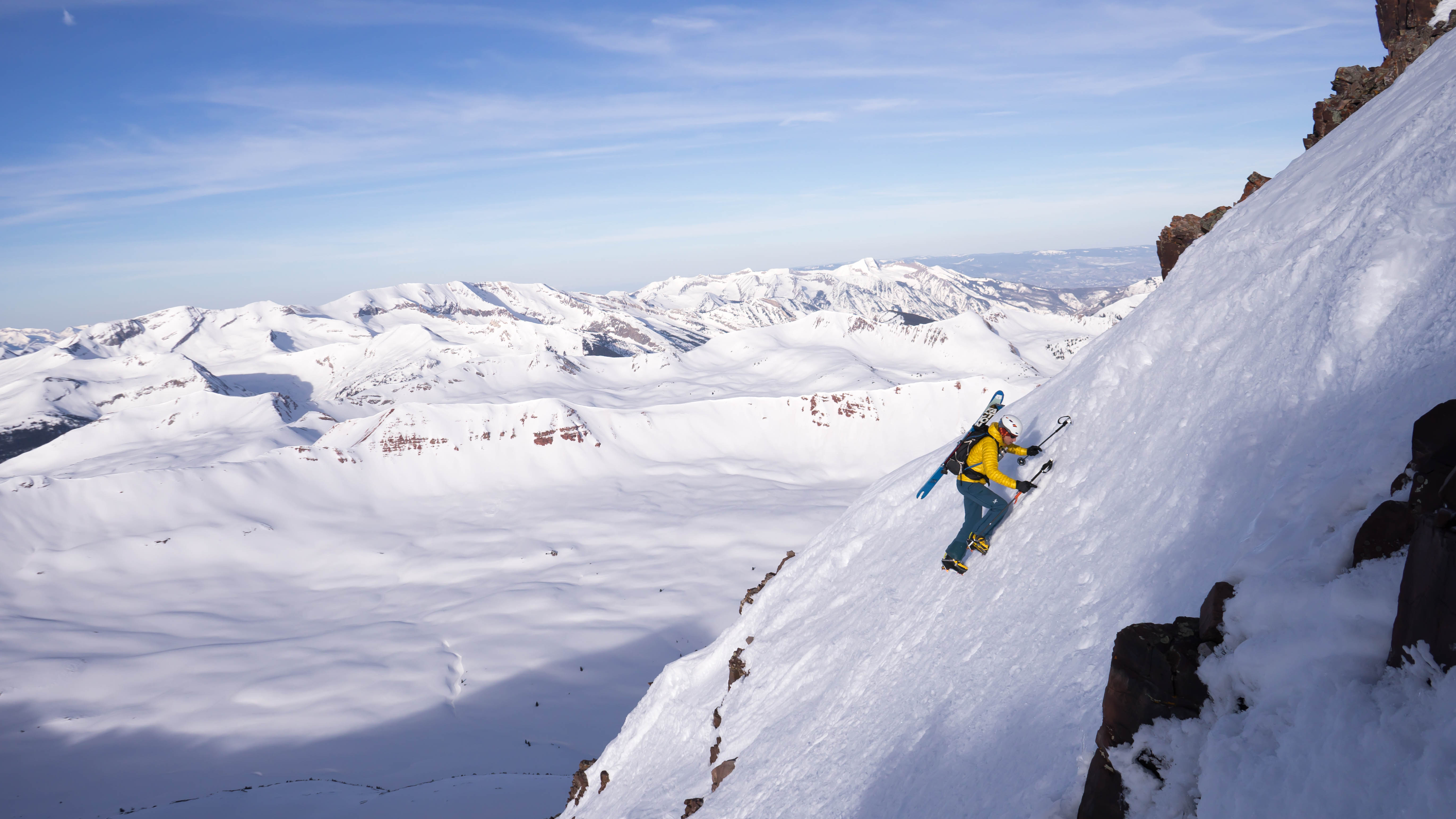
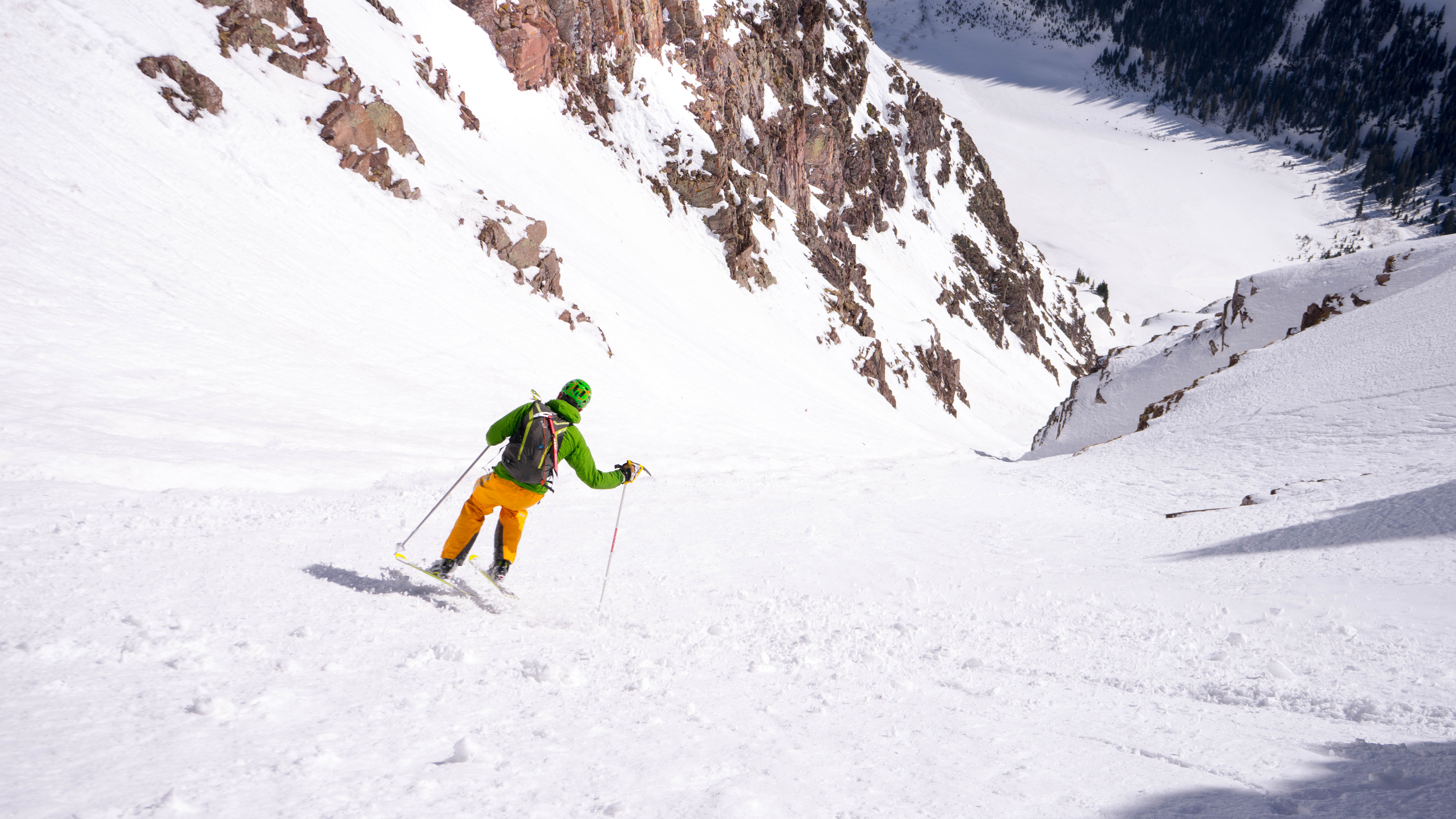
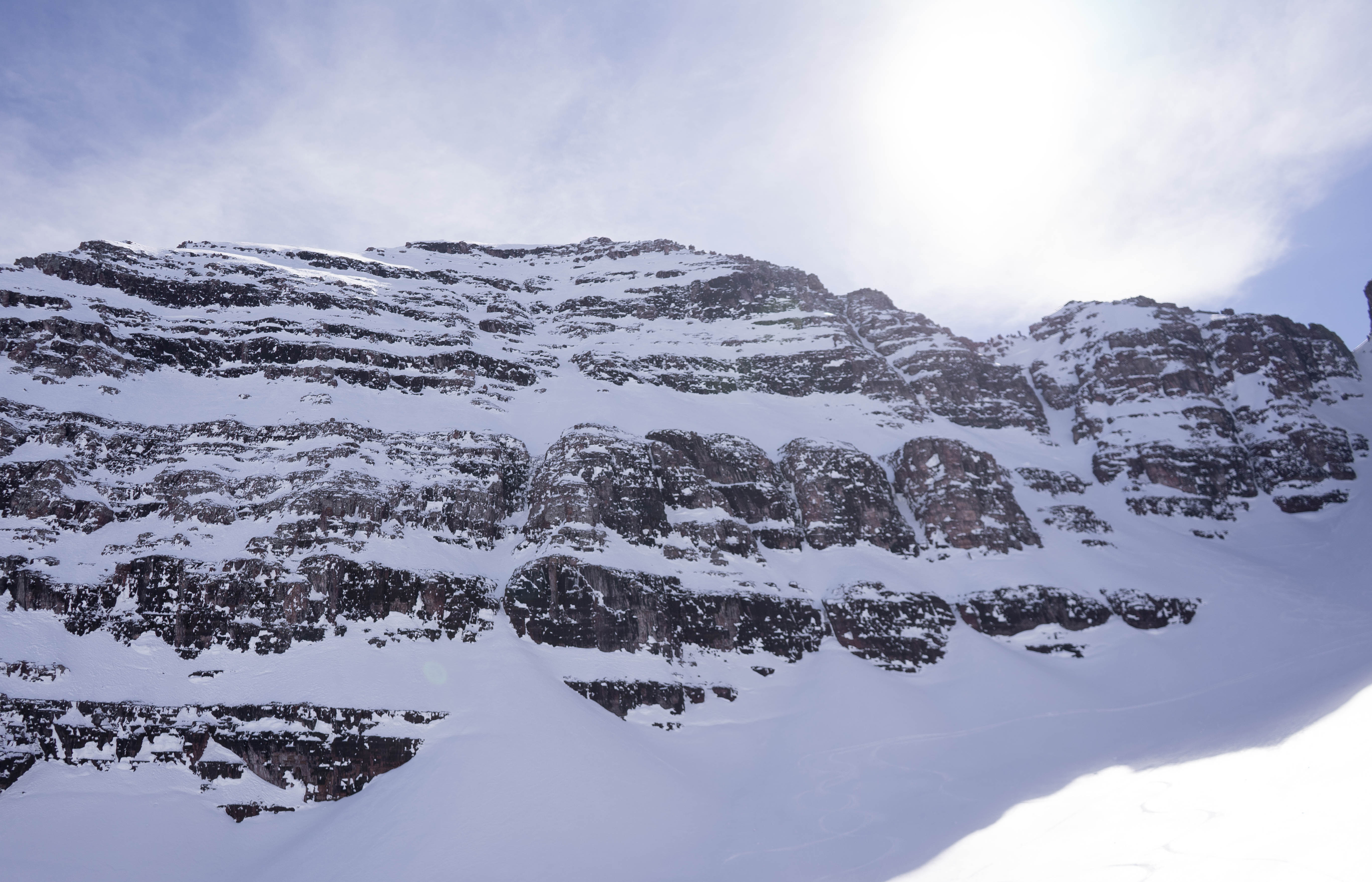
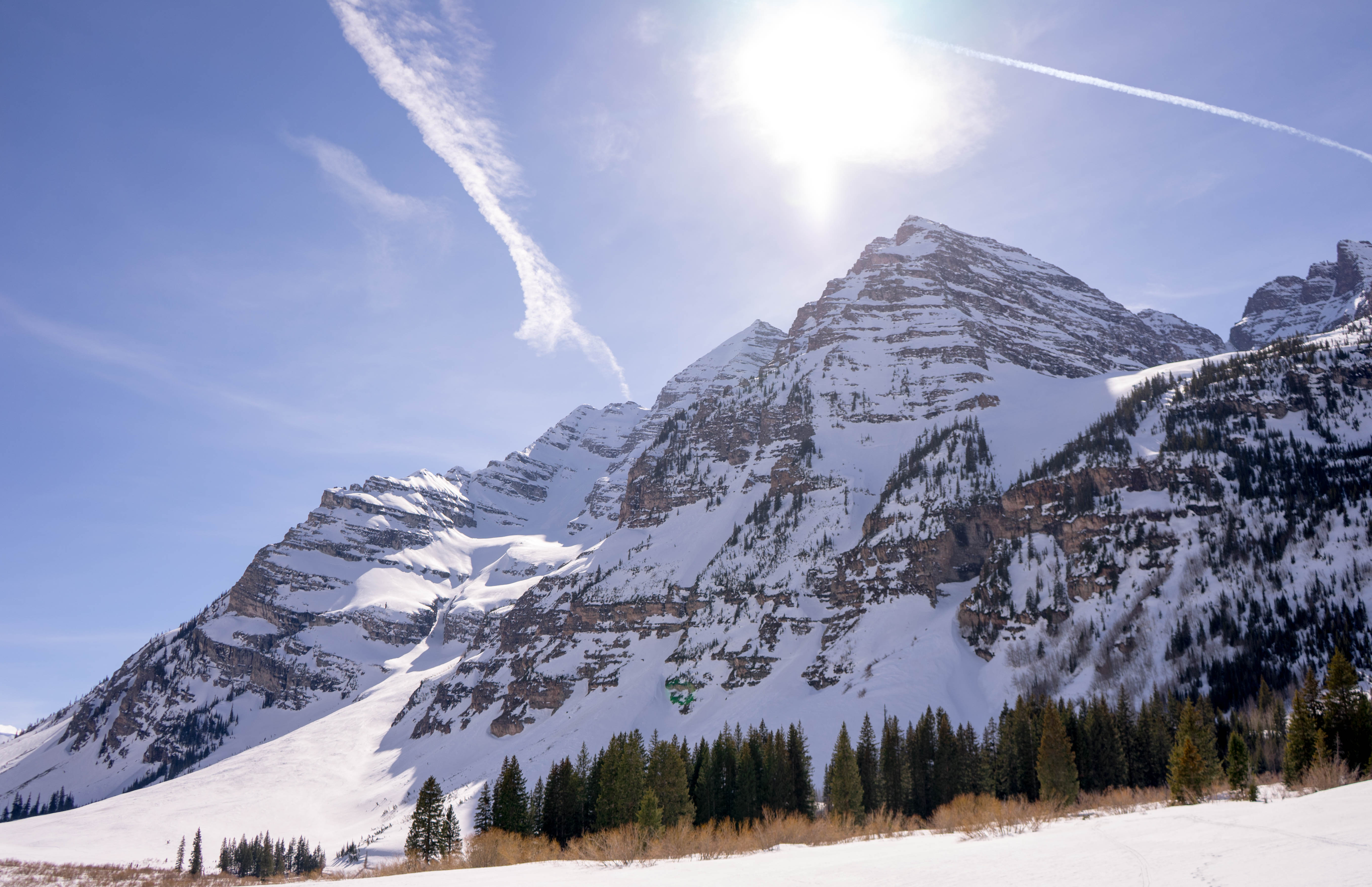
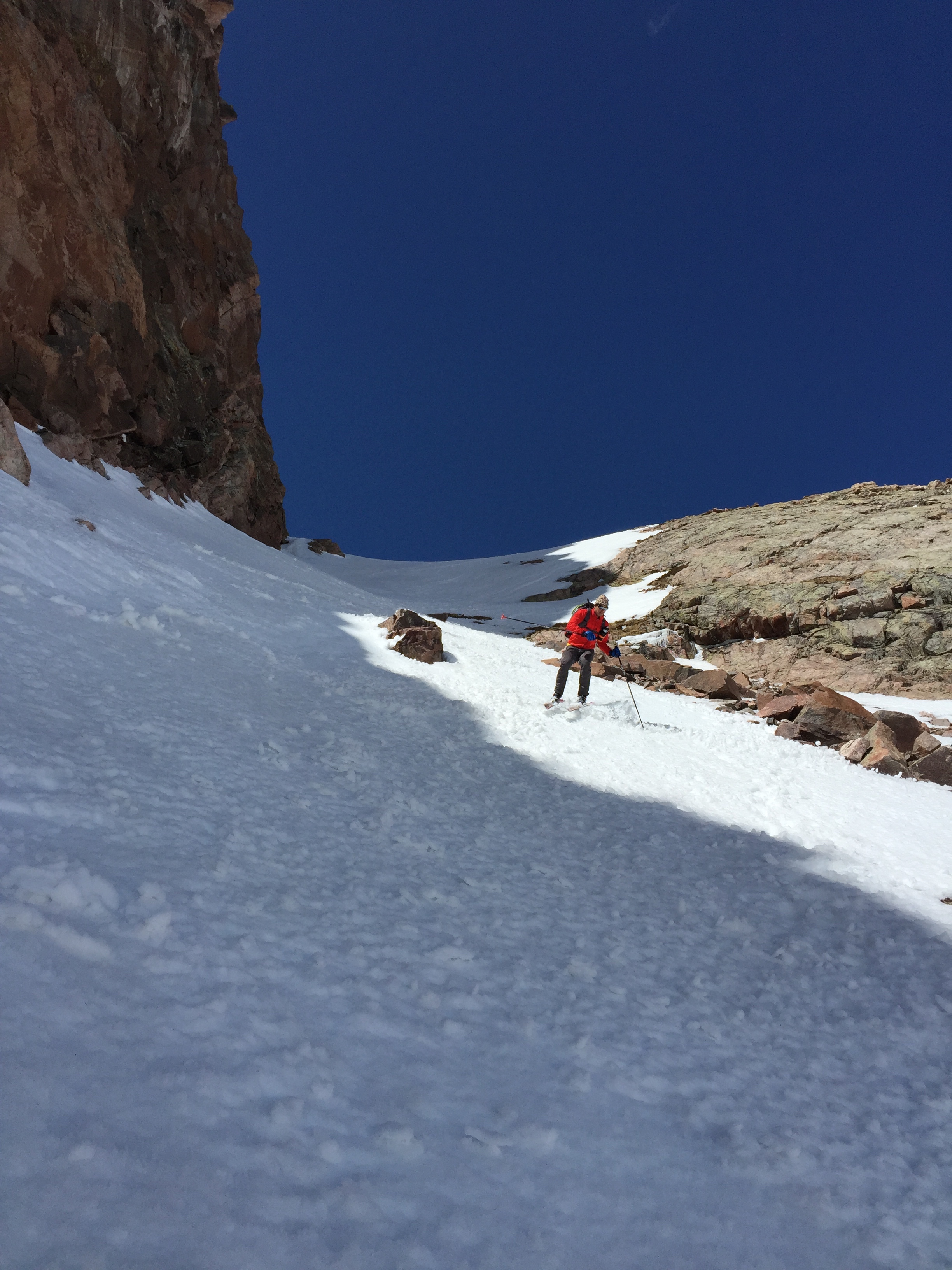
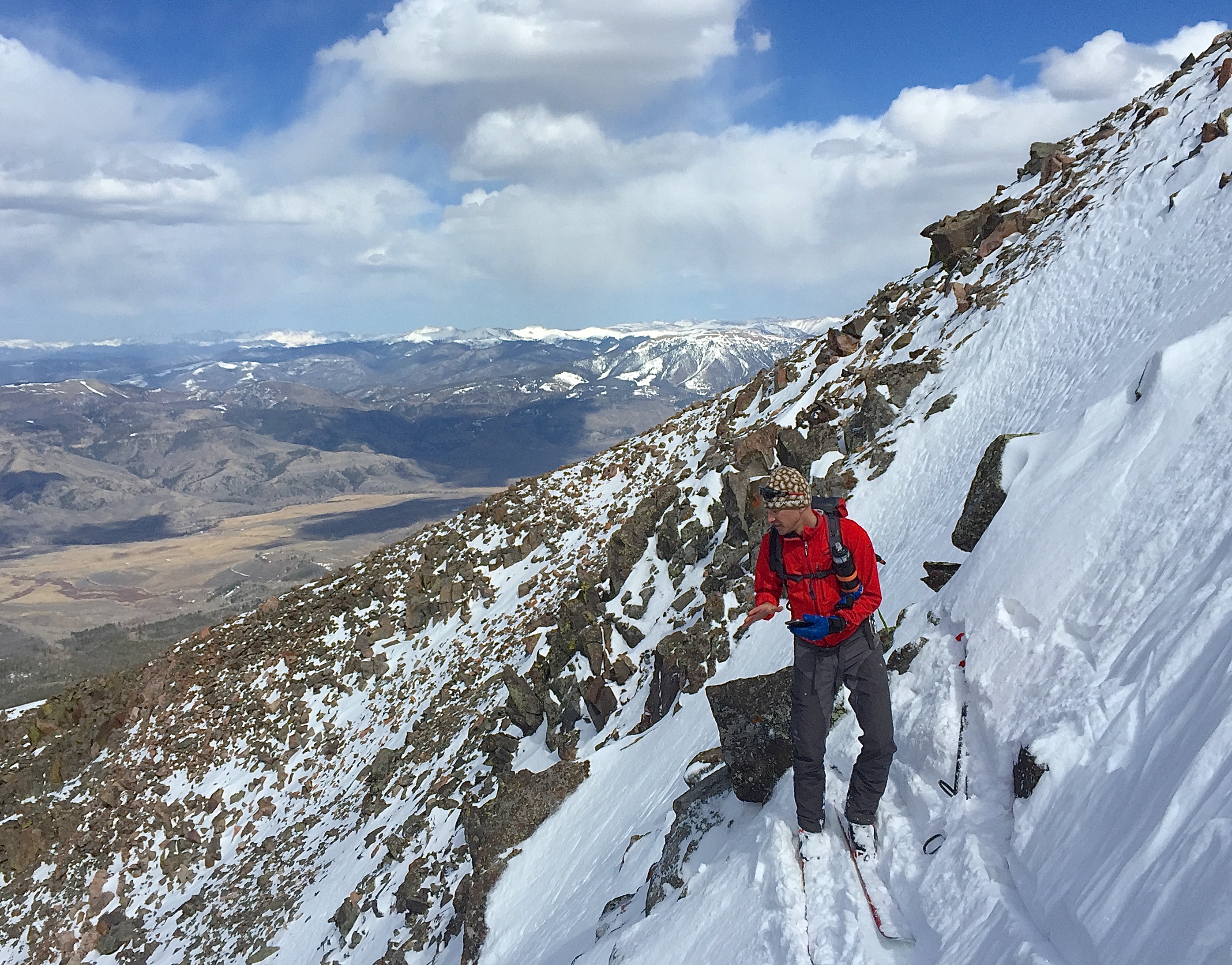
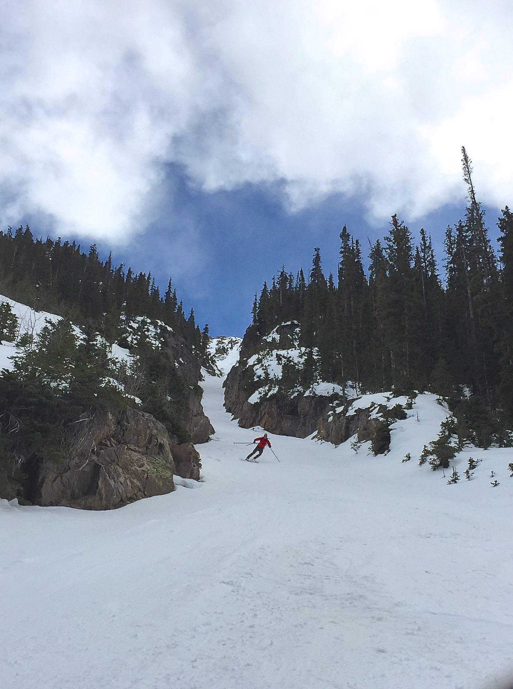
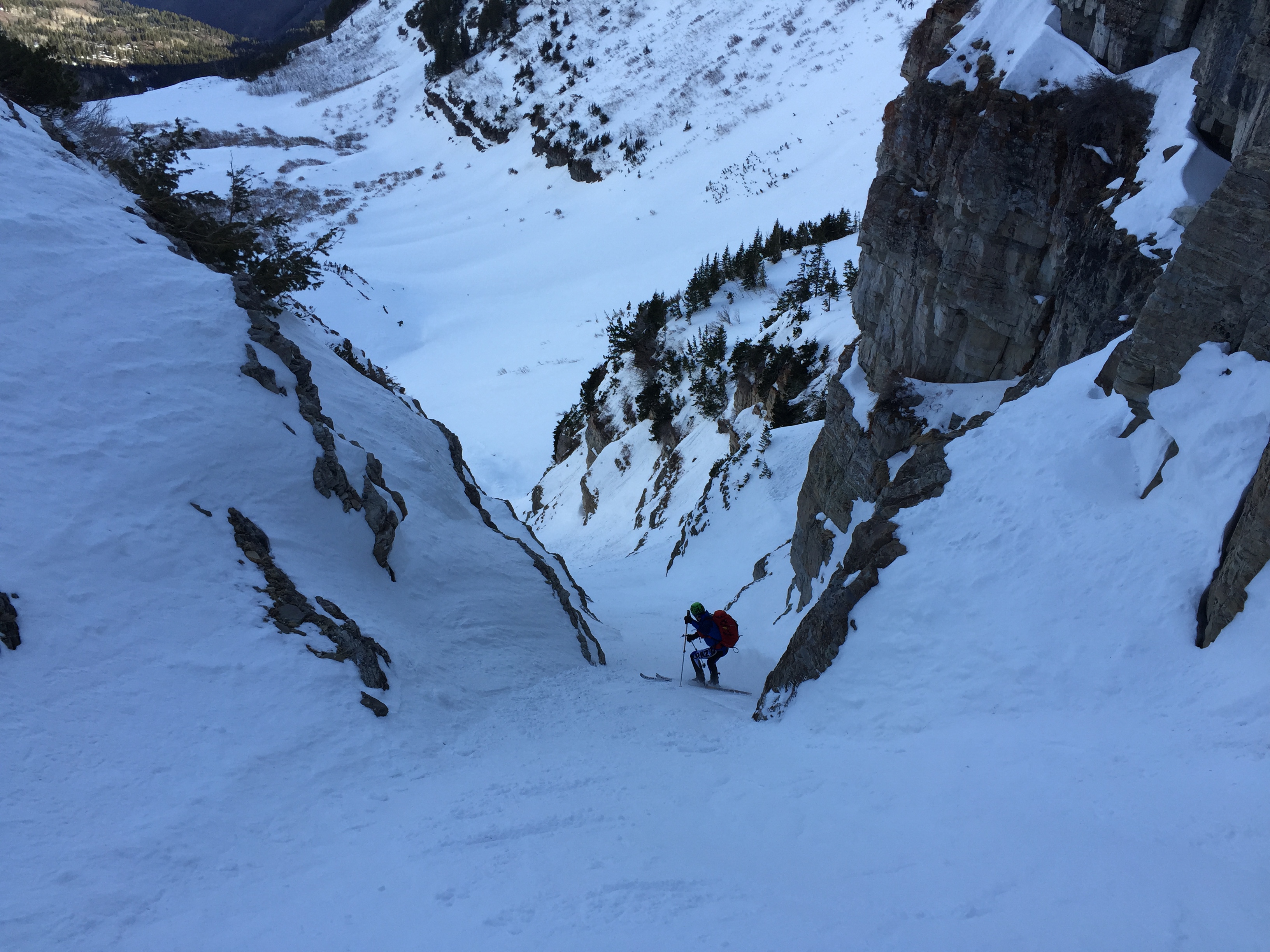
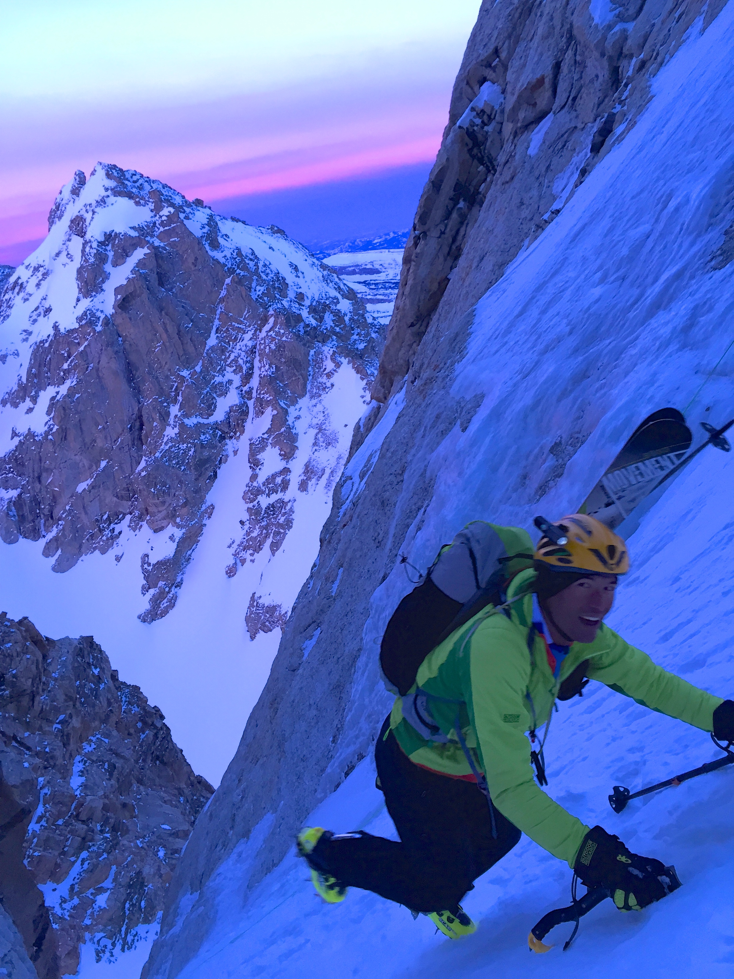
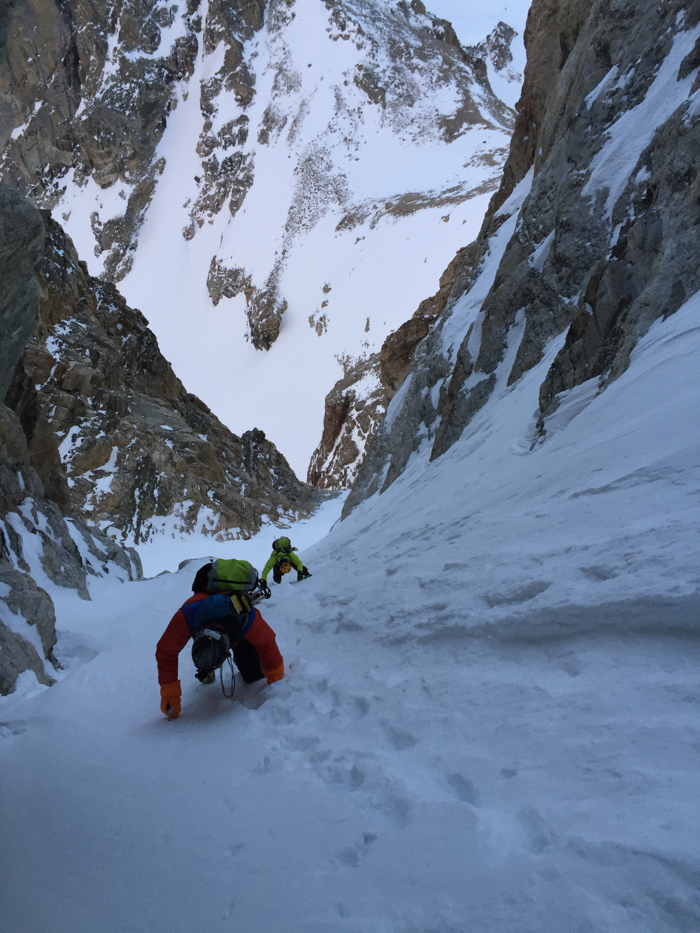
On the summit by 8:30 gave us plenty of time for the Bell Cord, though our minds were on the North Face of North Maroon. We did not want to be in that terrain if the winter snow was going to bake in the sun. Our saving grace, or so we hoped, was the lower mid March sun and the business of the line being between 12,500′ and 14000′. After waiting an hr on the summit for the temps to be a “slightly- early- just- right” we dropped in on the East Face of Maroon at 9:23. The sun had warmed the cold winter snow just enough to be perfect! We skied the steep east face for about 500 vert before catching the big wide obvious ramp that gains access to the Bell Cord proper. It was cold settled powder all the way down the right side and warm wet pow on the left. The ski conditions were all time!
The option to make a high traverse out of the Bell Cord to skip 1000’ of the 4000’ line was suggested. After some discussion we realized it was not for us. Beside the massive exposure and hazard that traverse would entail, we were there to ski the lines in their entirety. I mean WOWZA! they are really something! Traversing to chip them short to save on vert or ease the challenge diminished the direct beauty and length of these classic lines! We are out to SKI big beautiful lines from the summit to the lake! And style matters!
Go further?
There was also talk of the Trifecta. This would include Pyramid. Skiing 3 complete lines on all three Bells would be rad. The Trifecta would be 12,000′ of positive gain on three major lines. Many have dreamt and talked about it. There are a few combos that could work. But to ski all three lines true to their length would have to wait for another day, snow conditions and ‘we are not there yet’ if you know what I mean.
Ready boys!
The opening turns from the summit keep you honest
Cruise control!
On to North Maroon!
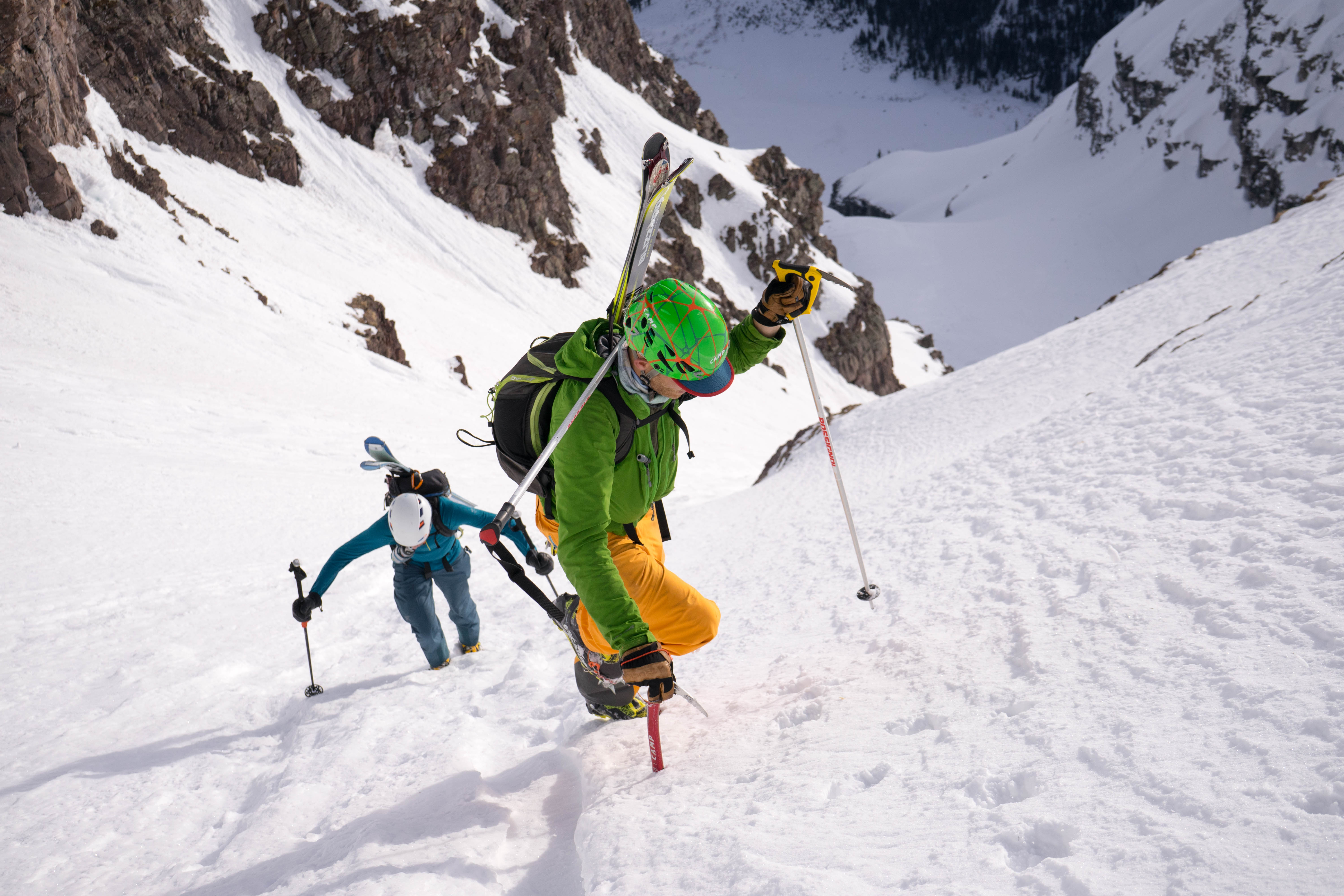
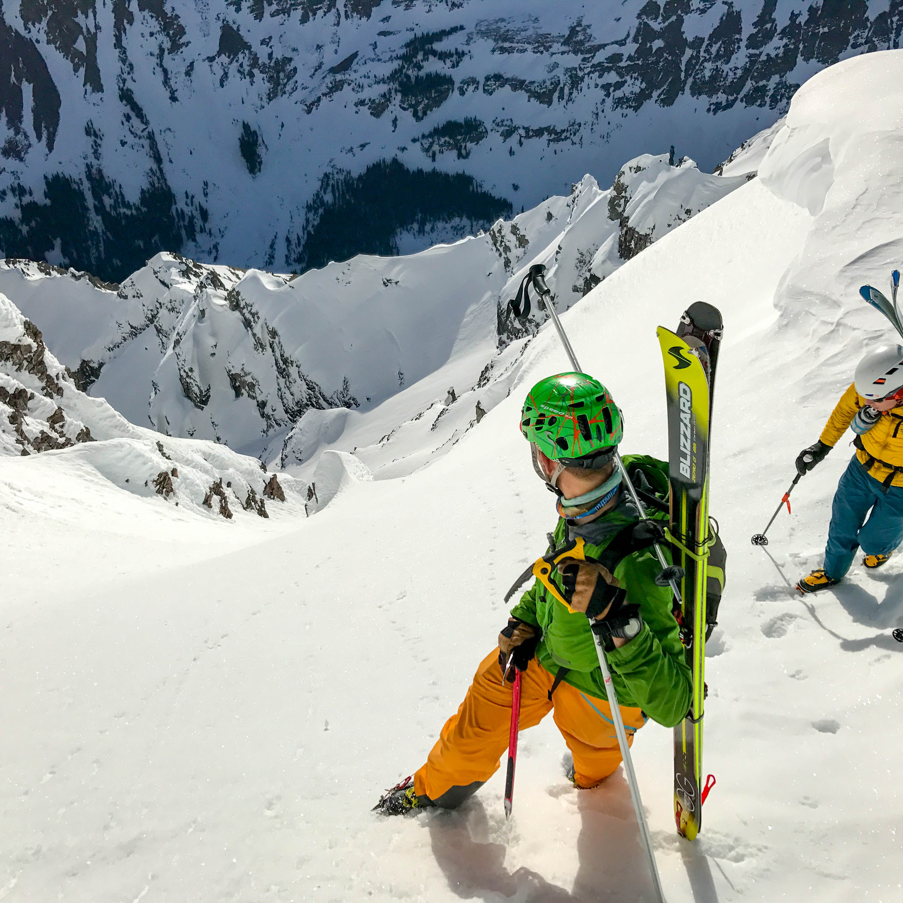
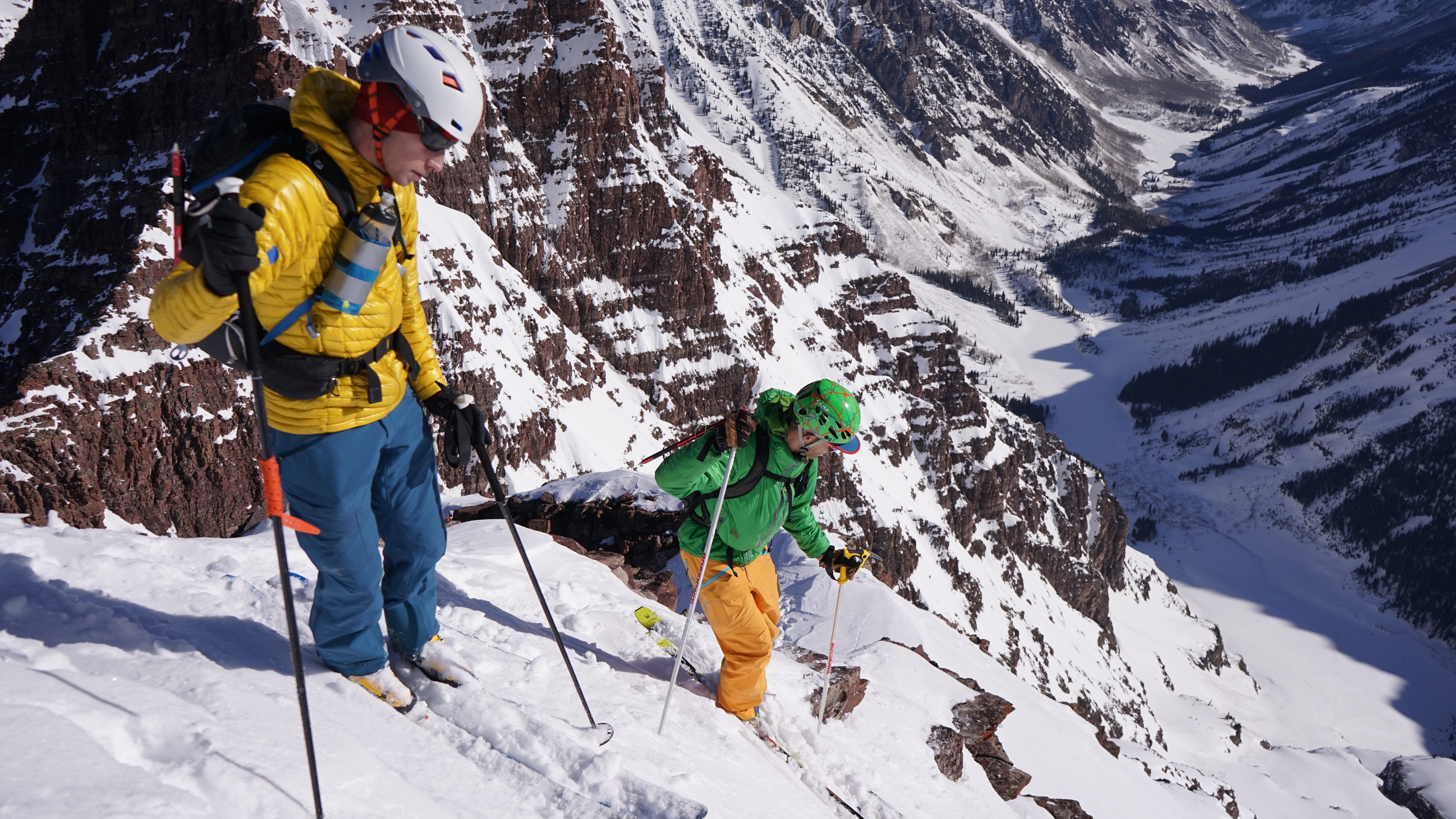
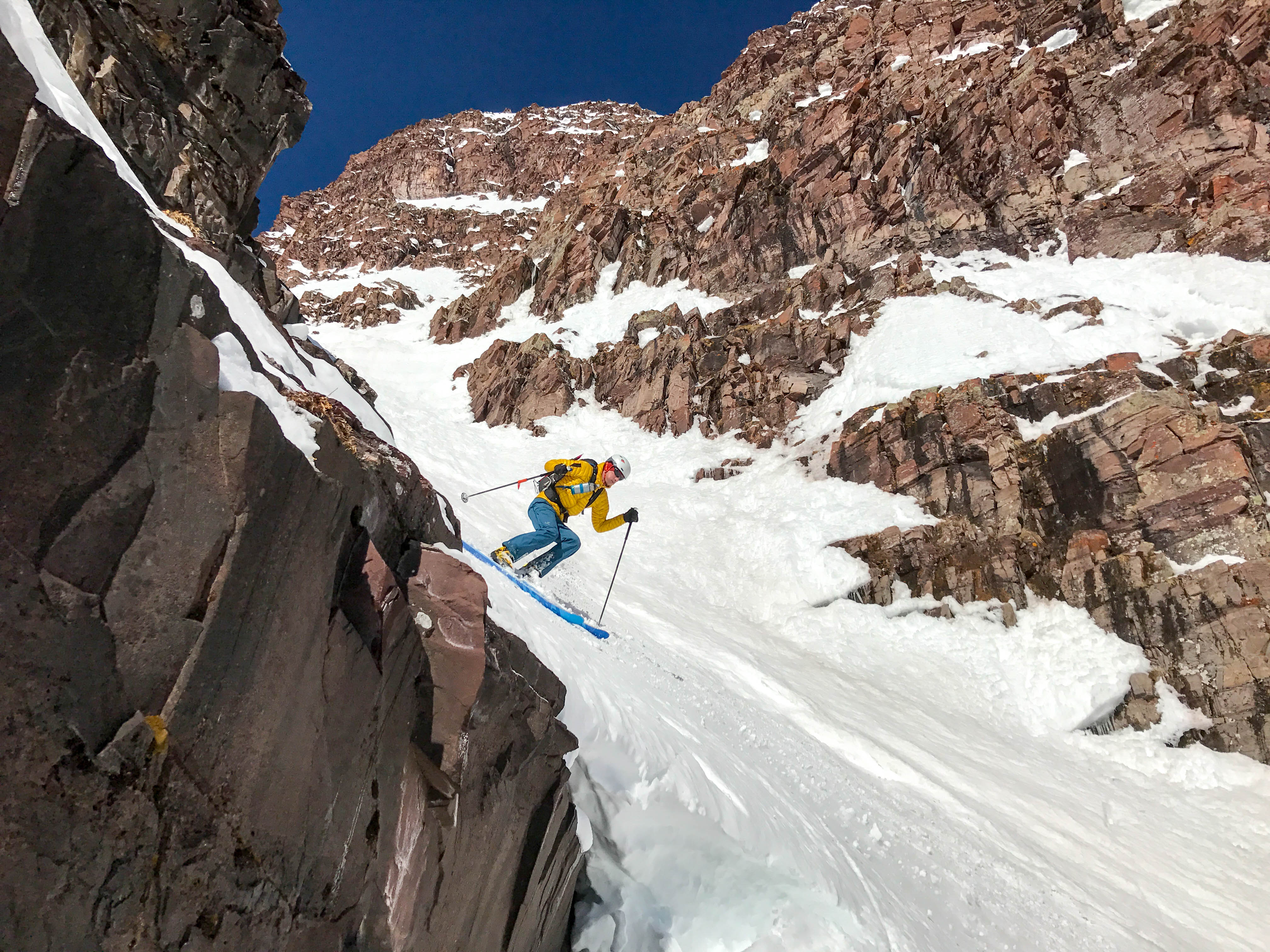
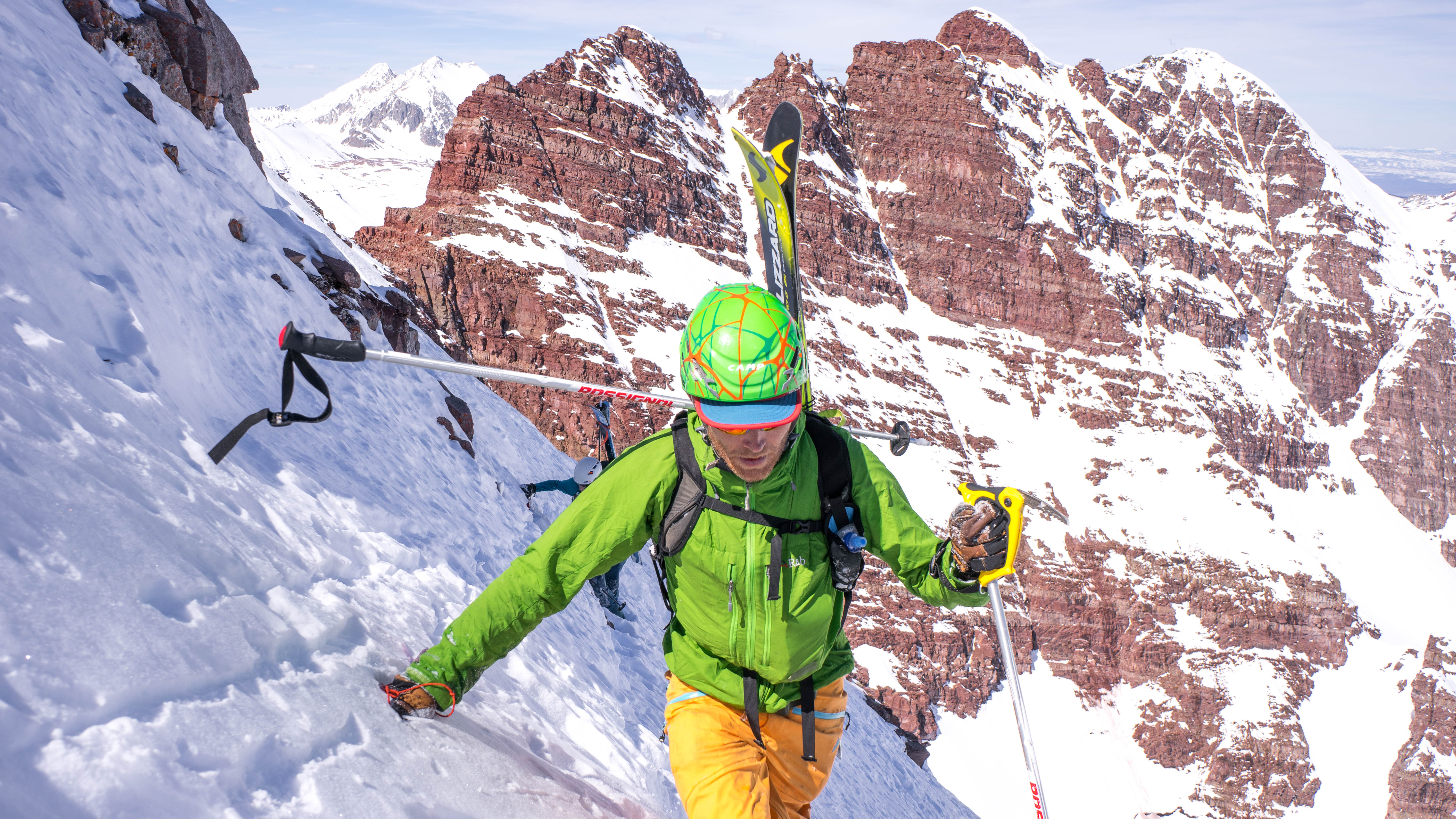
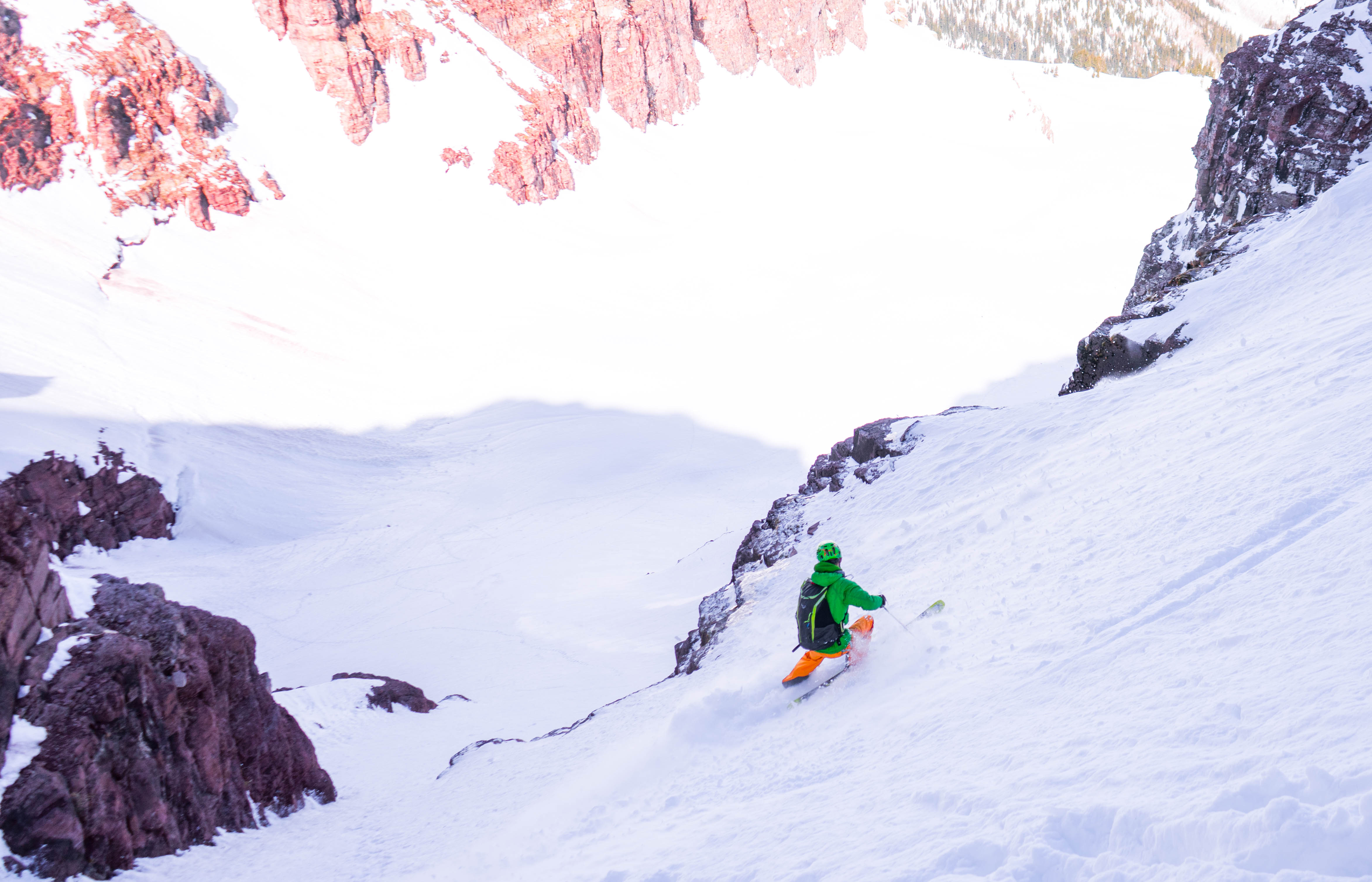
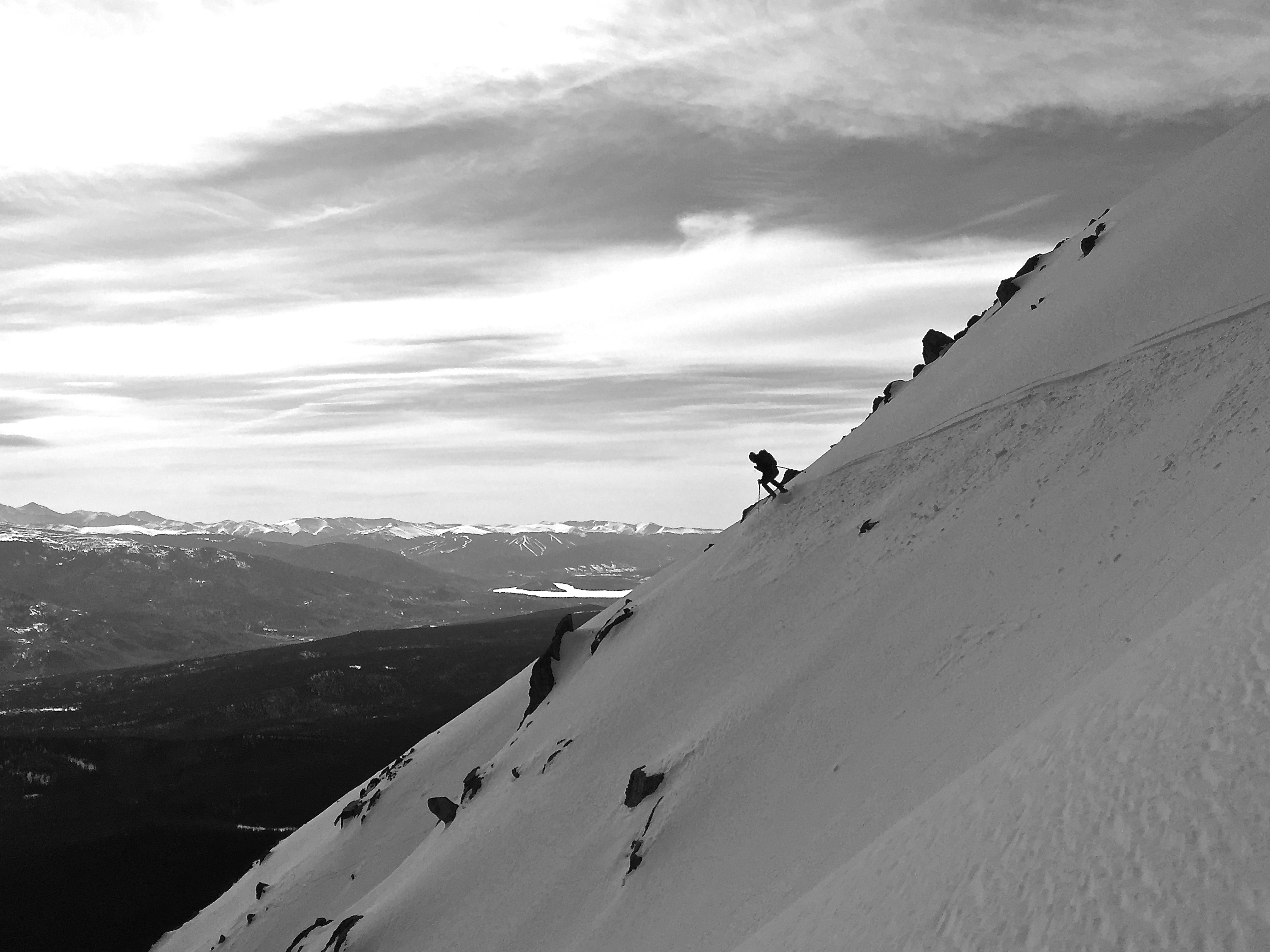
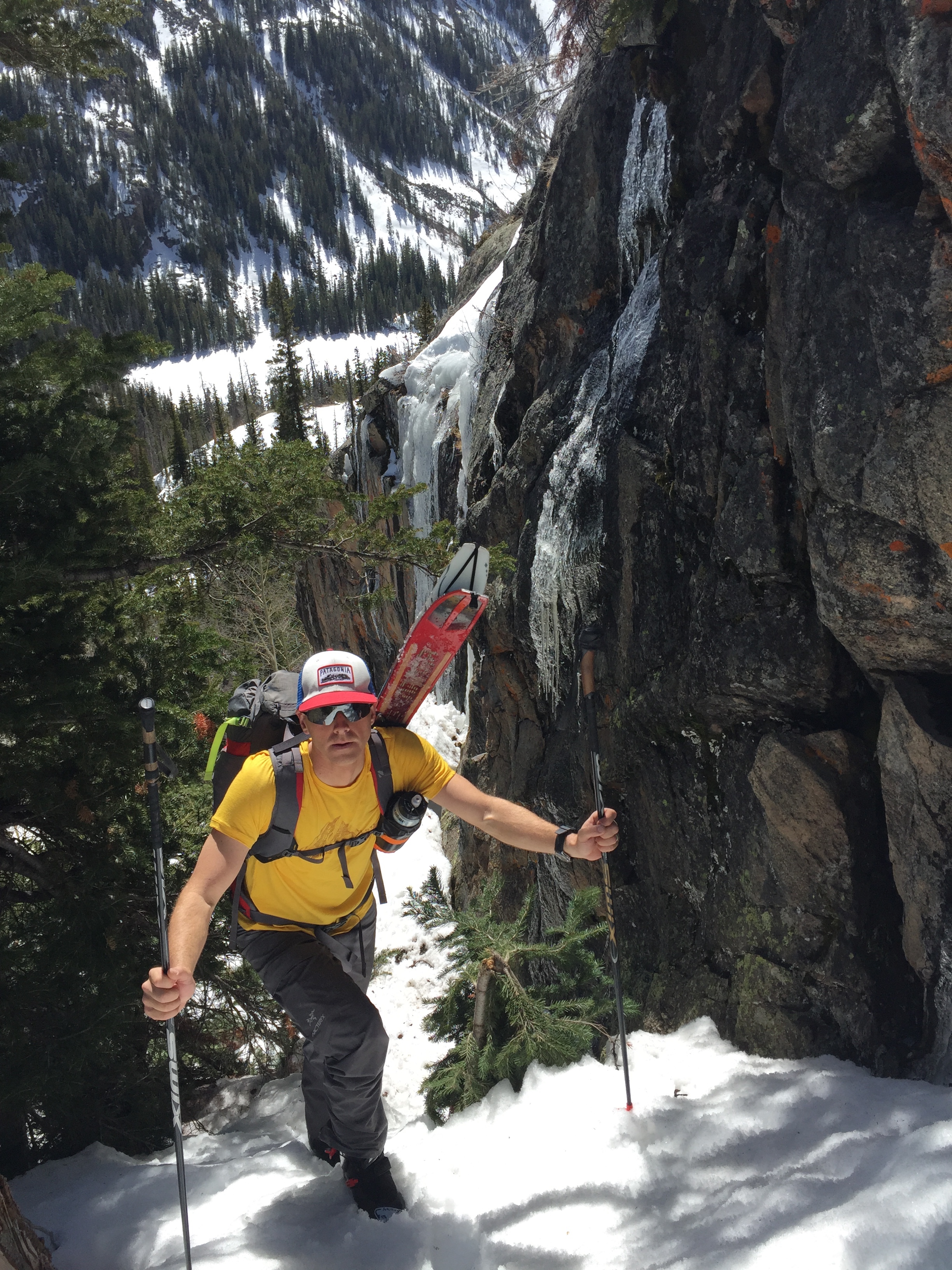
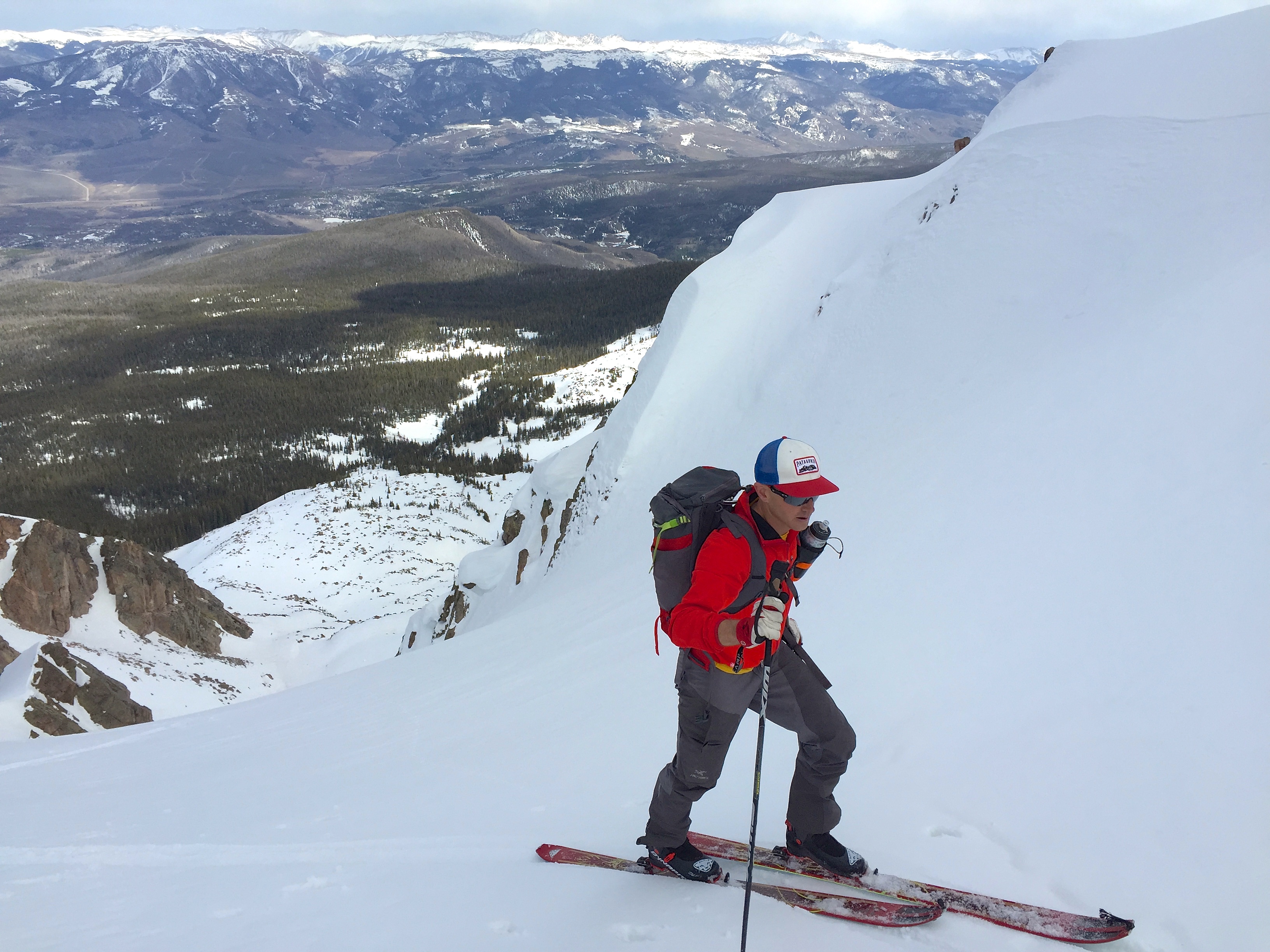
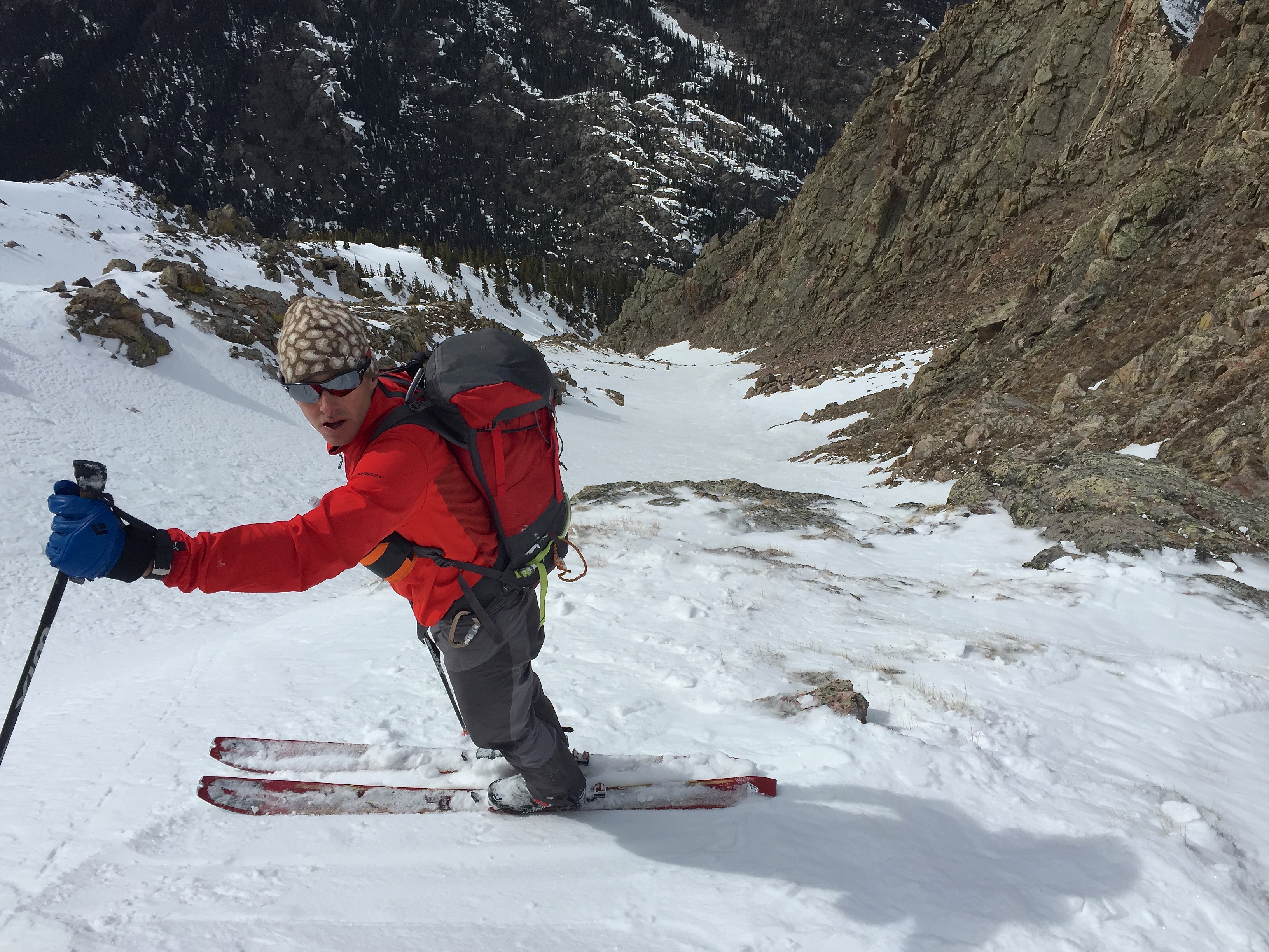
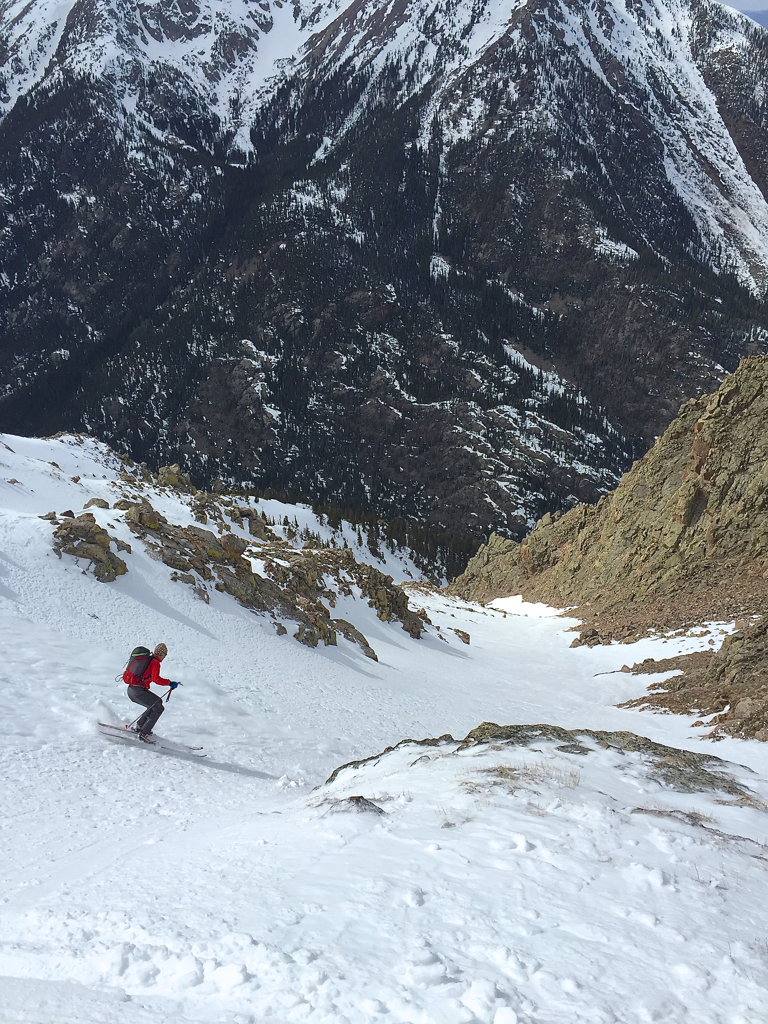
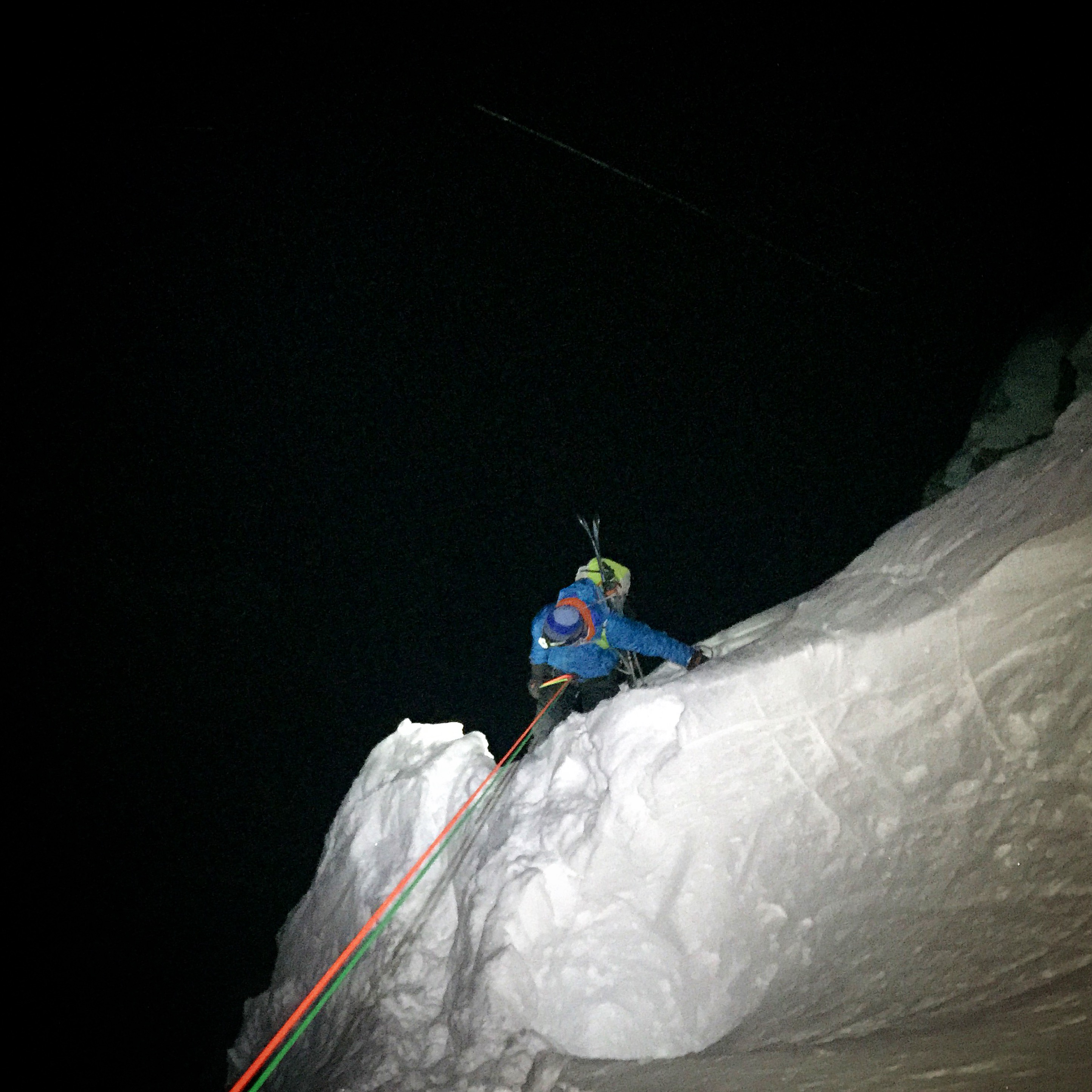
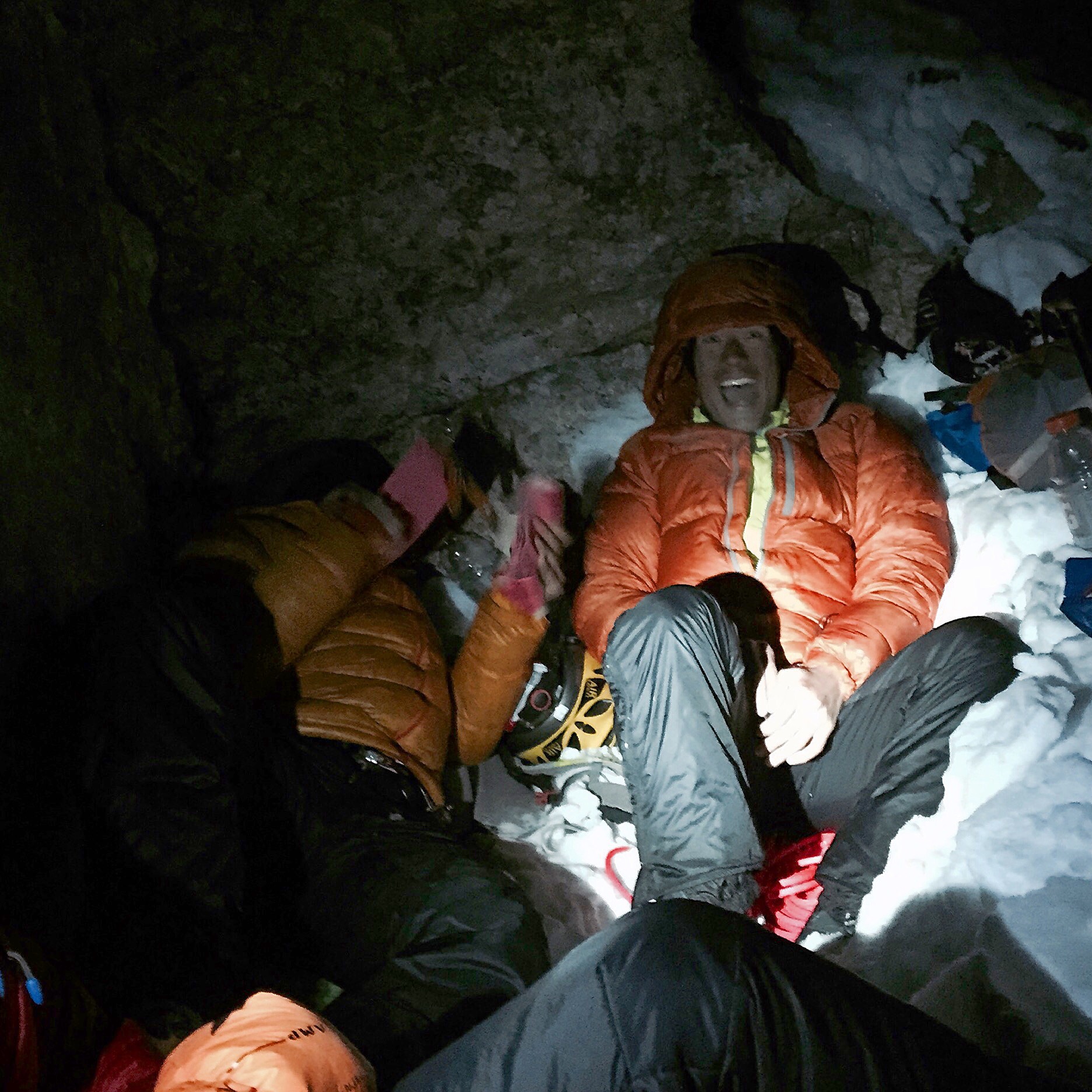
After skiing the line right to Crater Lake on valley floor, we skied up the drainage and ascended the North Face of North Maroon. The snow was “hot wet pow” in the trees below 11K and our confidence took a hit. Jason reassured us… “But that high North face under a mid march sun…” Once up under the tall cold face we were quite confident in the snow conditions at this point and chose to dig a hole and test our assessments again. After booting up and getting established on the first major ramp we assessed the snowpack and performed a CT and ECT. This large face is a complicated series of hanging snowfields, unsupported panels and frames of snow that are disconnected and peppered by major cliffs and rock. With this exposure, consequences, and it being late in the day, we really wanted to be confident in our stability assessment before committing to the massive exposure of this line. We found an unreactive, consolidated winter snowpack that supported the multitude of previous observations we had been making from our avalanche forecast to our ‘nowcast’. We did note new surface hoar development at 4’100 meters up to “punk pock. This could be a sliding surface problem after the next snow.
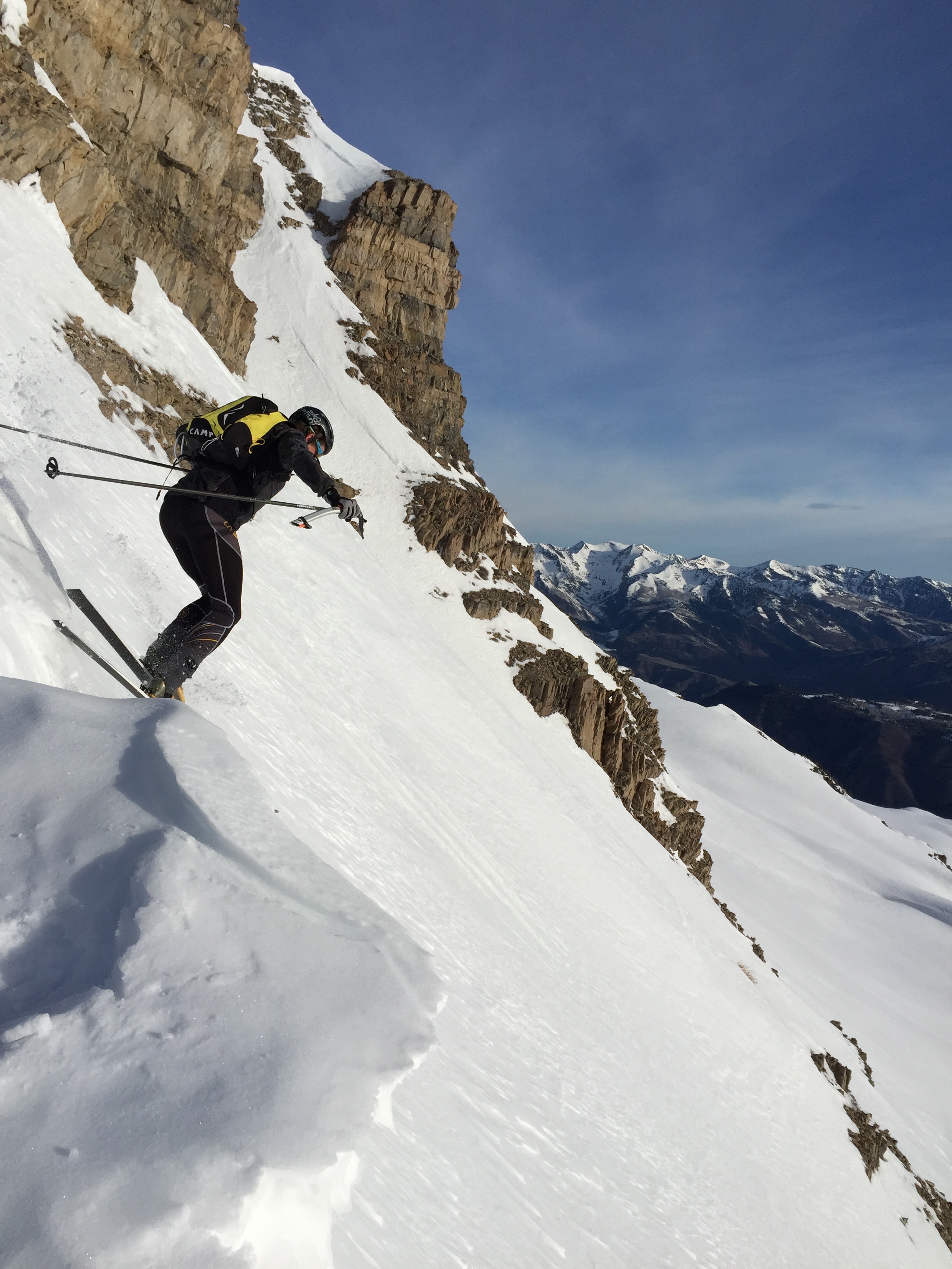
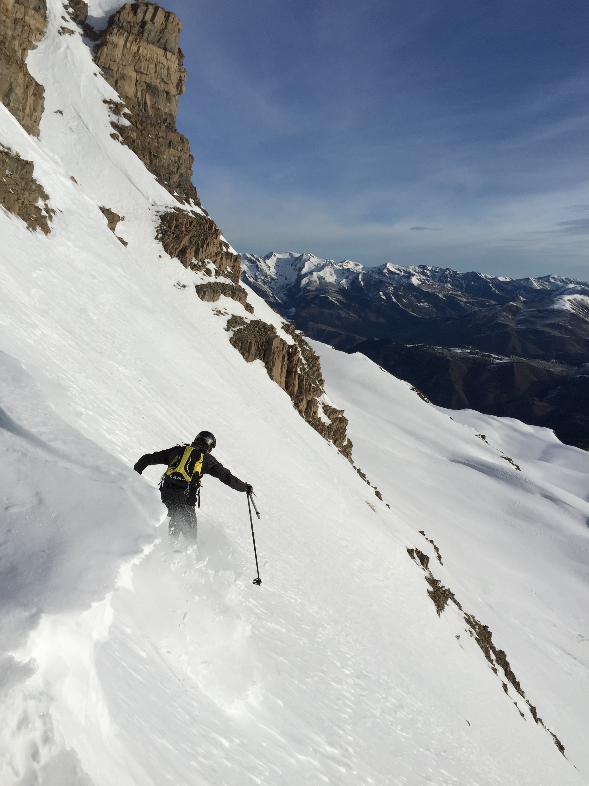
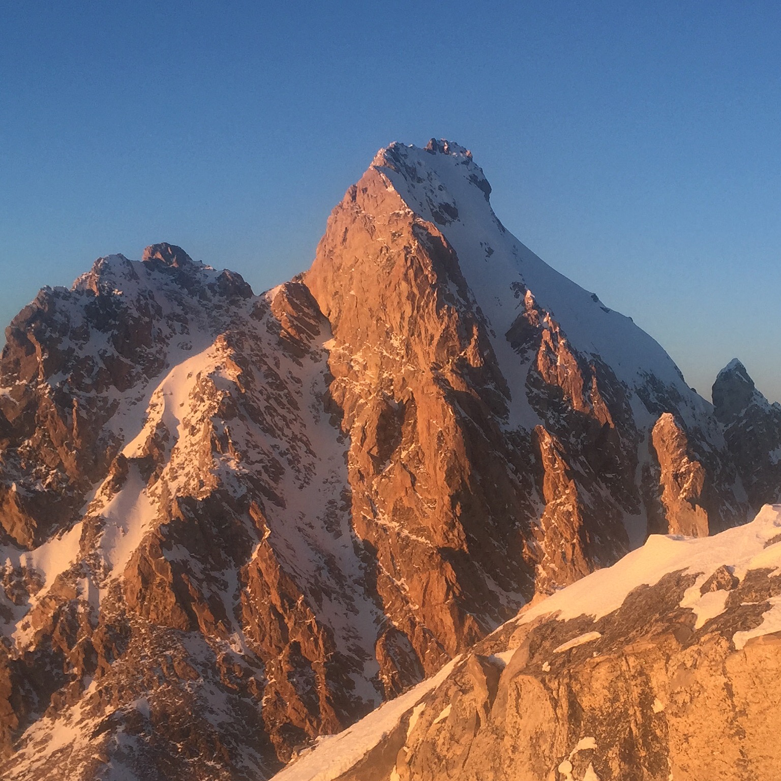
Chris approaches the foreshortened North Face North Maroon.
It looks way worse from this angle though.
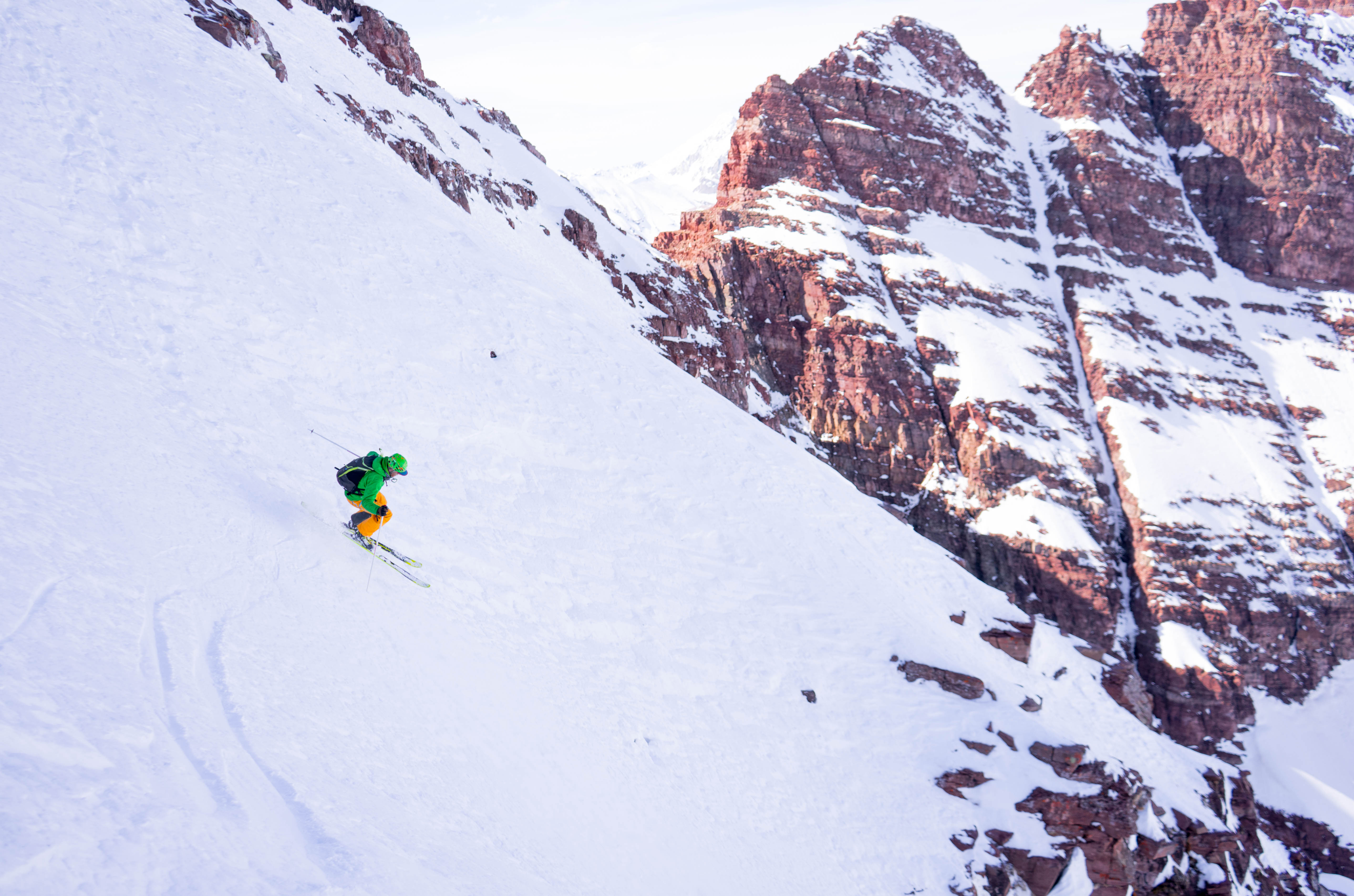
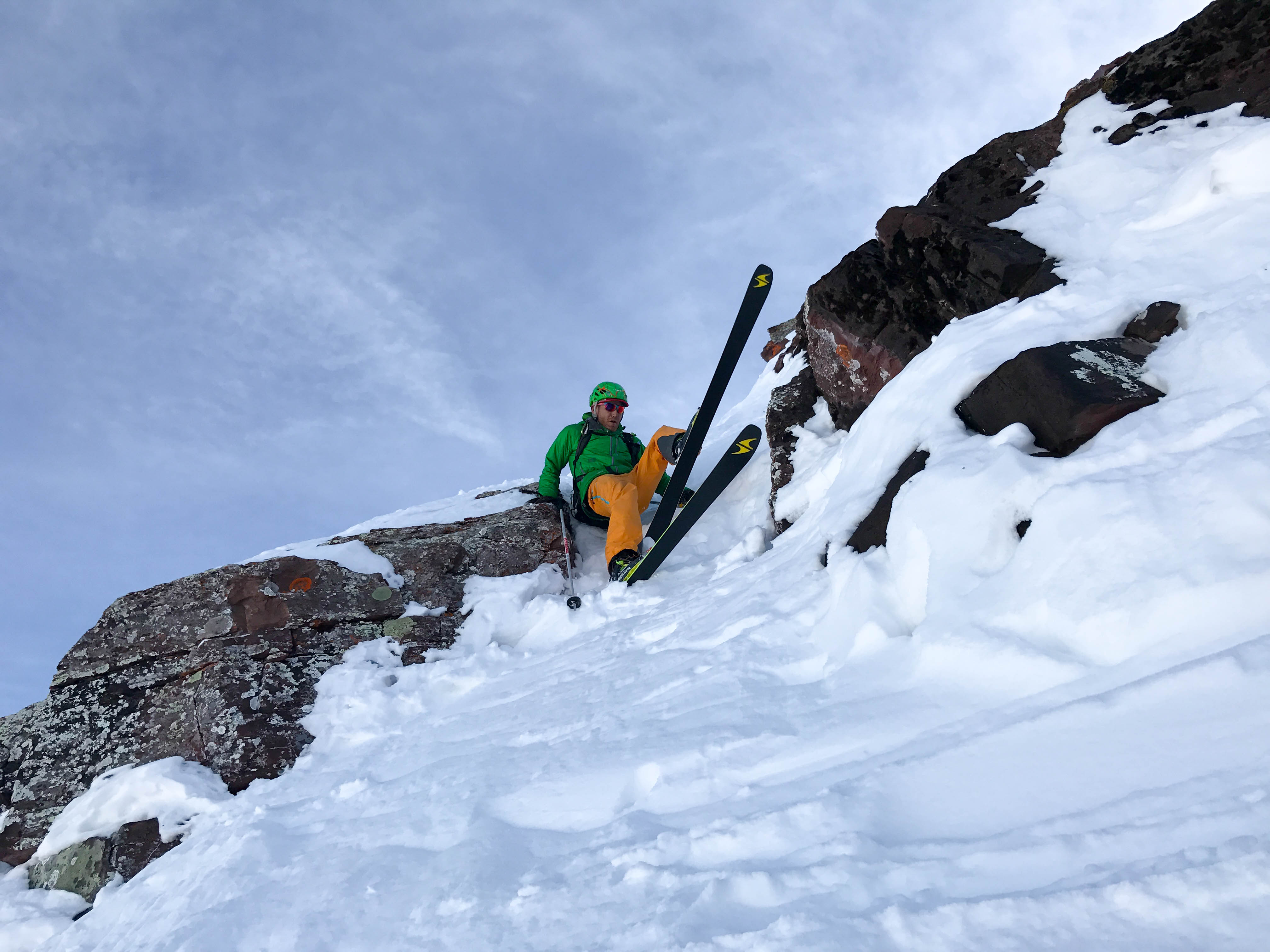
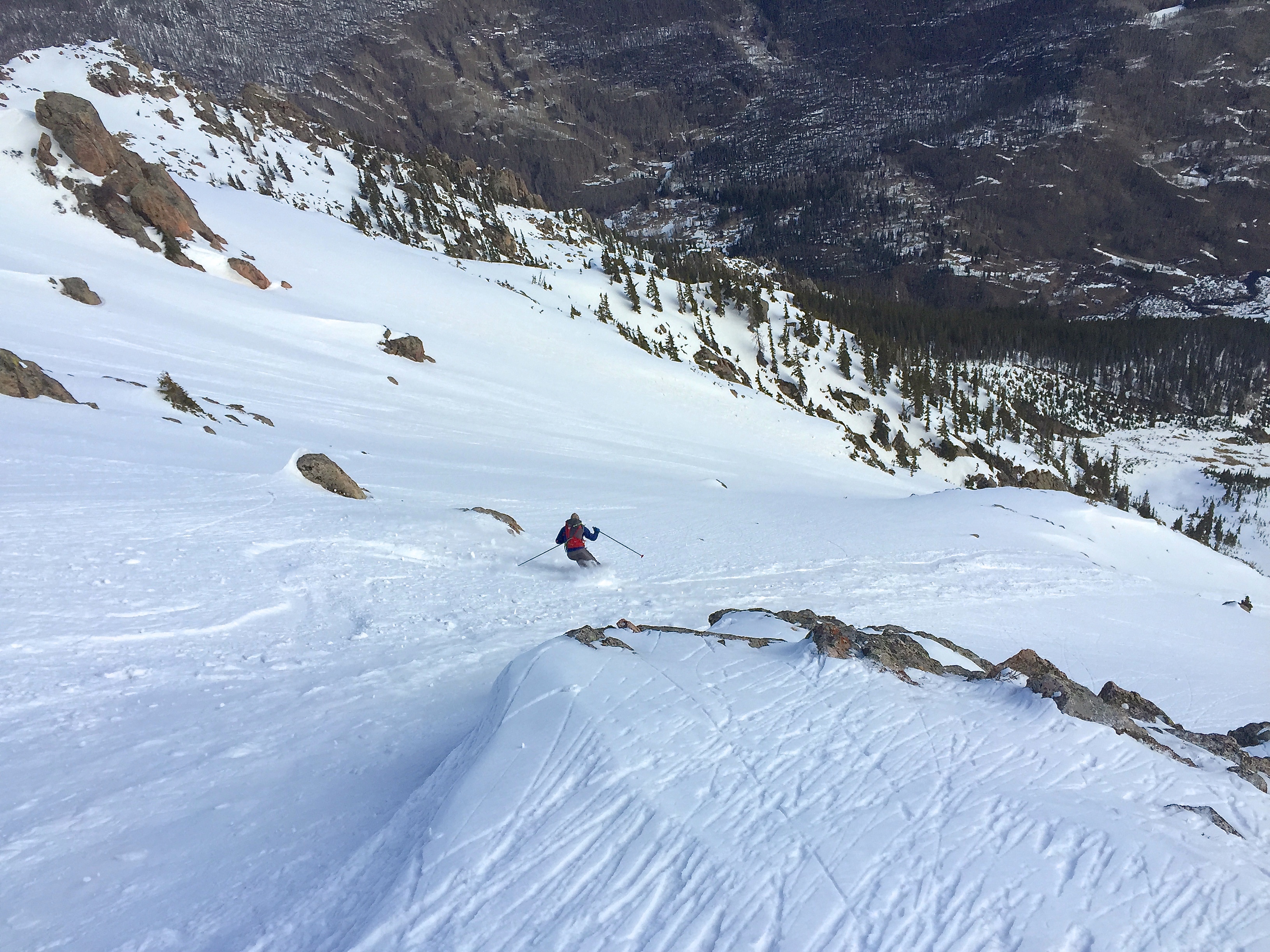
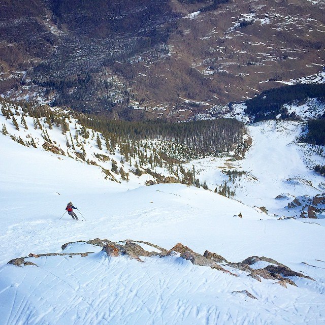
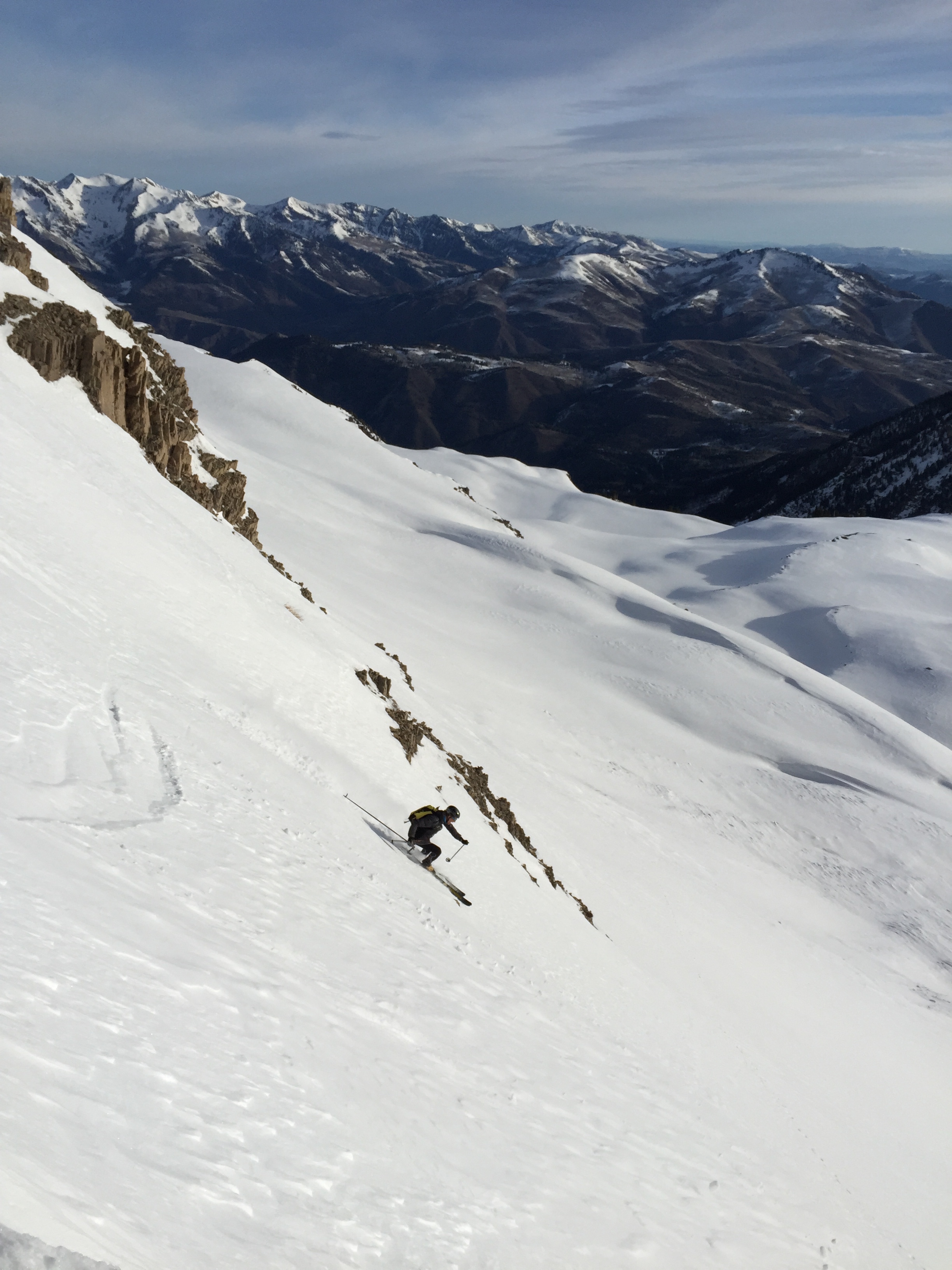
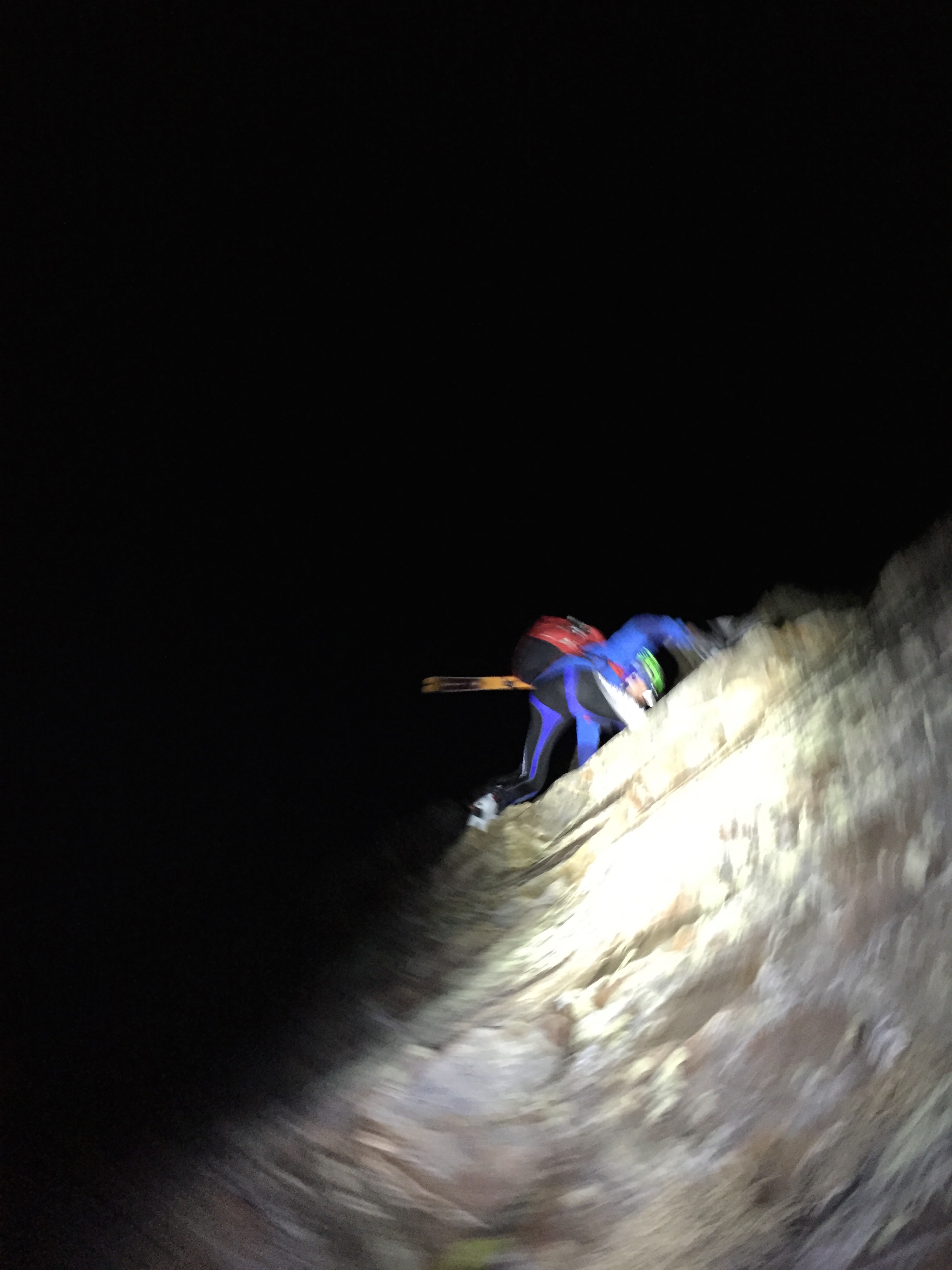
The North Face skied sooo well! Settled winter pow!! Also had to do three very short 1 meter dry ski steep moves at the crux in the center couloir. No problem here.
Jason and Chris use flawless ‘dry ski technique’ to pass a tight spots.
We choose to link both lines to their completion at the lake in one day, all human power from the ‘everyman’s’ winter trail head at T Lazy 7 Ranch 8200’. Jason and I had left Breckenridge around 12:30am and met Chris at the trail head at 3:30am. We all skied out to the safety of the lower apron below the North face at 2:30 pm. This was a culmination of incredible snow and weather forecasting by the team. Light, bold and efficient ski touring technique made it a fun tour!
23 miles (37kilometers RT
10,300′ (3140k) vert and all smiles n high fives!
(8941’ from Maroon Lake)
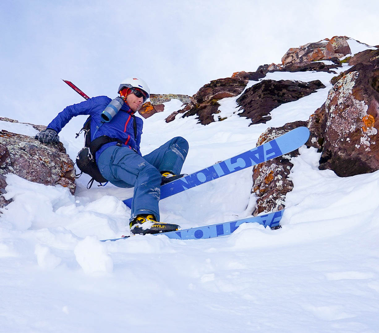
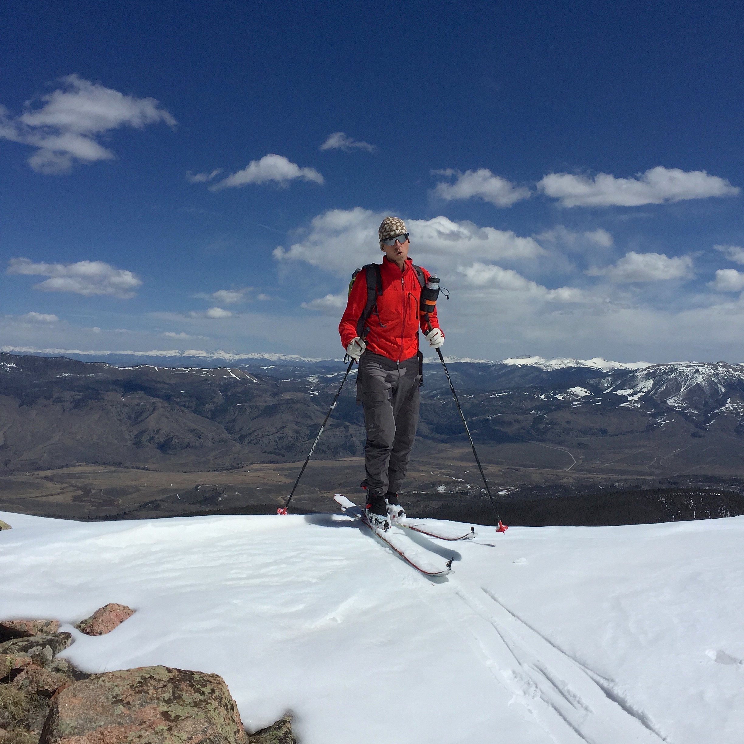
The 2017/18 Alien RS is a game changer. No really you watch.
Gear and Style
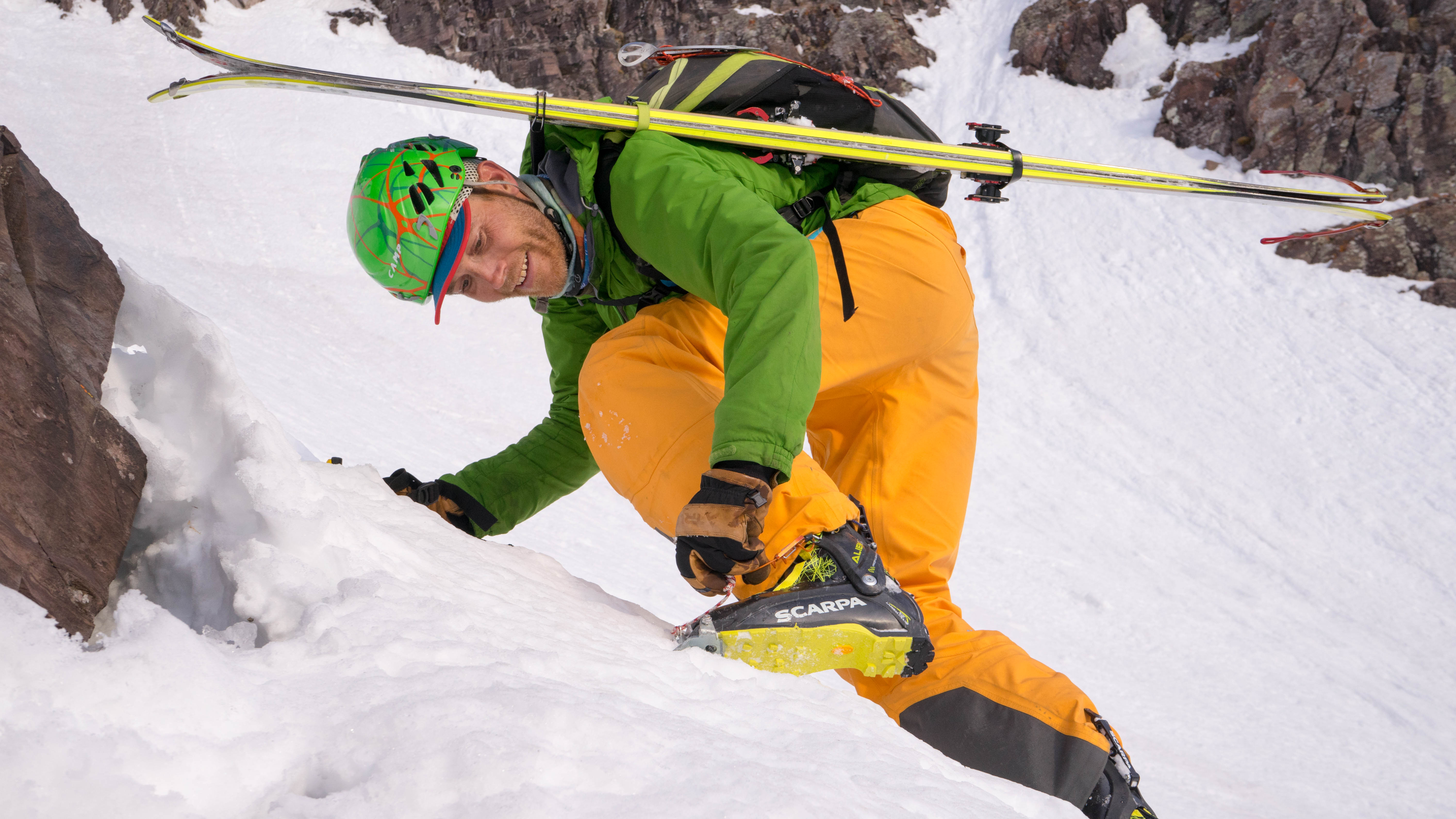
Both Chris Baldwin and I were on Faction Agent 90 Skis, 1350 gram skis and ‘freeridey! Jason and I were on Scarpa Aliens. Jason the Alien RS and I on the full carbon Alien 3.0. We all use a Plume Guide toe, combined with a Plume Race heal, binding combos. One can charge if the skill and touch match. Perfect set up for remote big mountain missions when you want to really ski! More to come about equipment, techniques and choices that enable quality skiing, in a much shorter amount of time and effort.
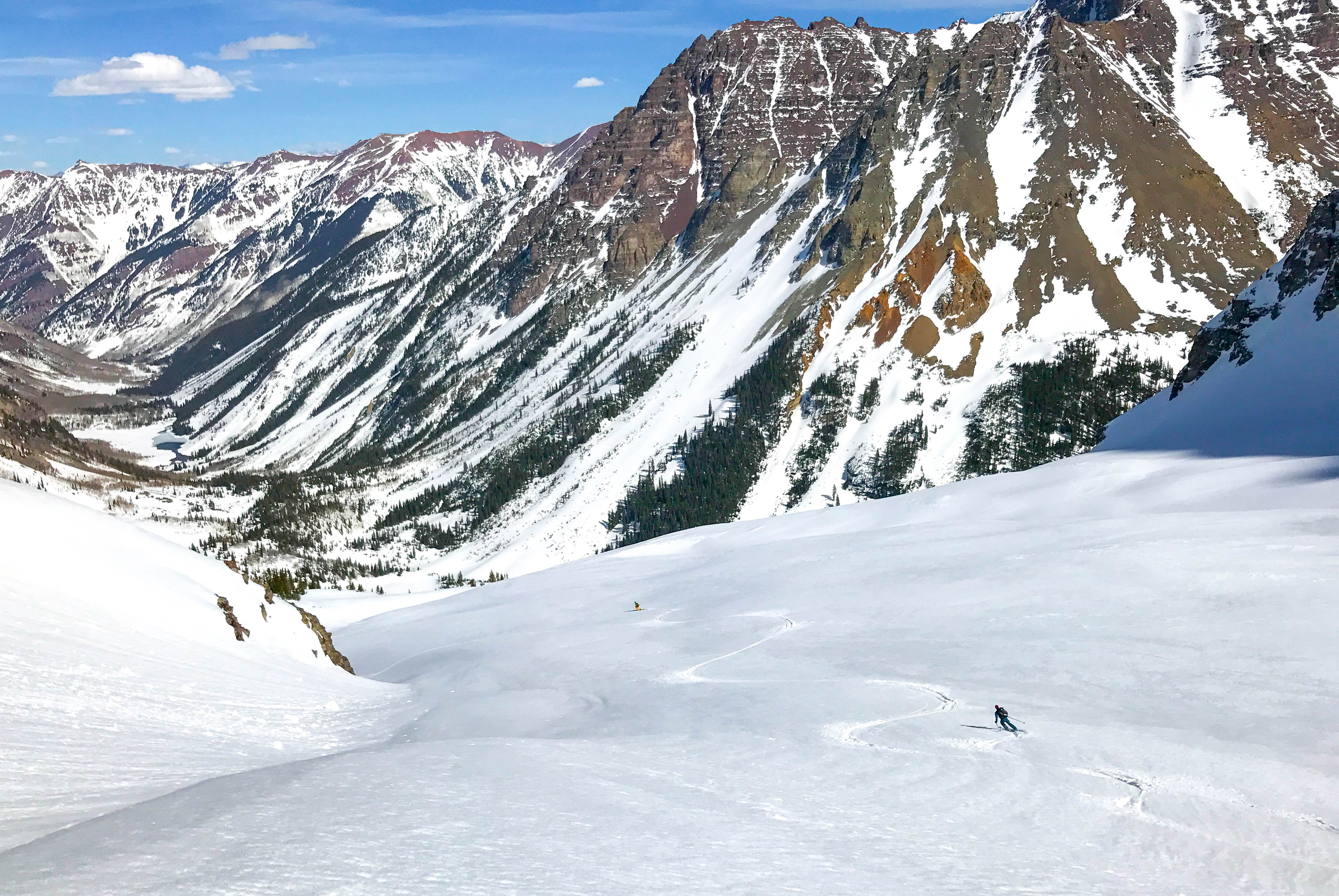
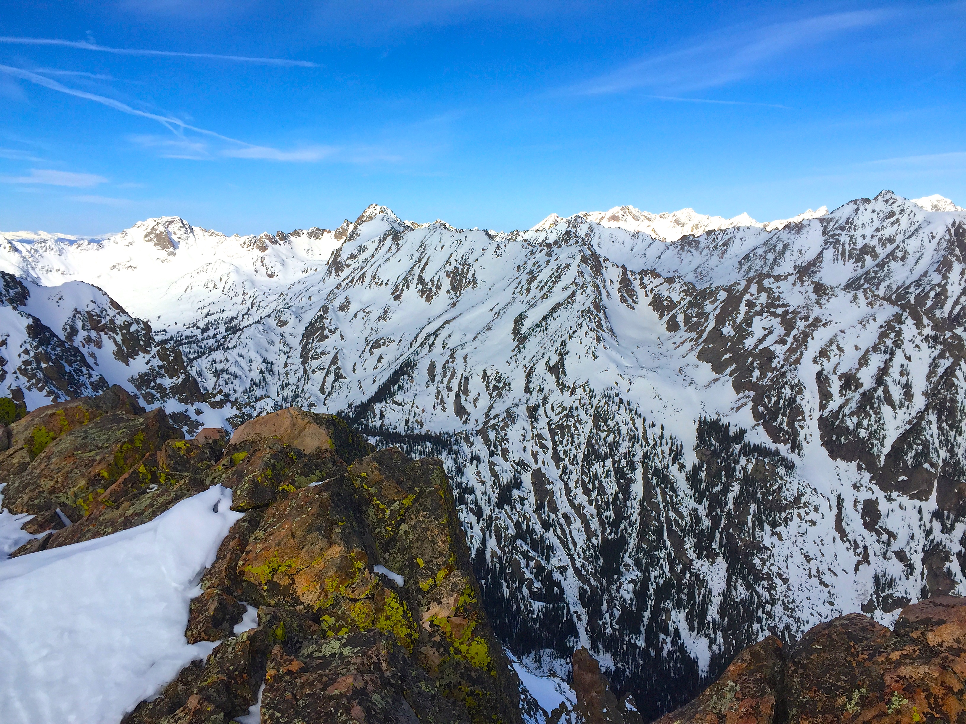
We get a charge out of putting it all together. Isn’t it the process, the mystery in the journey that engages us? – The NE face of Bloodshaw and the NW Couloir of Peak O seemed so far from access points. The Gore mountain Range is so far away right? I was first inspired to ski these two lines a couple years ago while driving by the Gore Mountains. You know, rubbernecking with an eye for the biggest and best ski lines you can spy. During the pre trip route finding research we found no record of prior descents. Perfect. (surely they’ve been skied, how could the biggest faces in the range be overlooked) When there is no trail or skin track to the summit, no info available on how to navigate the complex face, and no complete photos to show if the line even goes, you know your in for a memorable day. – The rugged approach comes together and we are standing on the nearly 13,000′ summit, way out there, somewhere in the Gore Mountain Wilderness. I’m now staring down the barrel of the towering North East face of Bloodshaw. It’s powder from the summit, so we asses its stability, again. We trust each other’s judgement. We’d better be right. I look down 3,600′ to the river bed below. This line feels heavy, it feels different than some others. I pause for a moment to take in this place, the gravity, the moment of a mystery being realized. Does it go? – I roll in on cold soft powder, when all I’ve seen lately is corn or a little tired old storm snow. Floaty and smooth, way out there, exposed on this towering face, it was like skiing in suspended disbelief. We found our way through chutes, over ribs, around cliffs and eventually down to the massive run out and last steep pitch to the Slate River. What a ski run. And those conditions! We transition and search for a place to cross. It’s a ways to go to gain Peak O. Plenty of time to wonder of its North West Couloir. What will it ski like? Two more couloirs to get there… Once we gain the ridge can we climb to the summit? It’s a long ways out from west of Black Lake. I really hope it goes.
Mike laughs after realizing it would go in 4 hours car to car. Not bad for “The Gore Range”
SE of Peak O May have skied a new line here
Has this been skied?How about this one? Seems unlikely.Mike Schilling ascending a long SE couloir on Peak OLines for life in the Gore RangeMike Schilling walks the ridge to Peak O’s Summit
Michael Schilling drops into the 3,200′ Northwest Couloir of Peak O Gore Range ColoradoHa! and it finishes with a tight walls 600′ slot!We gad to break through thin ice until we got onto supportive ice. This was my least favorite part of the adventure.
It’s funny how our perceptions are changed. Time, people who go before, personal bests and trying adventures change our perception of what is possible. And it’s just damn fun to hang it out there and realize the mystery of a new adventure.
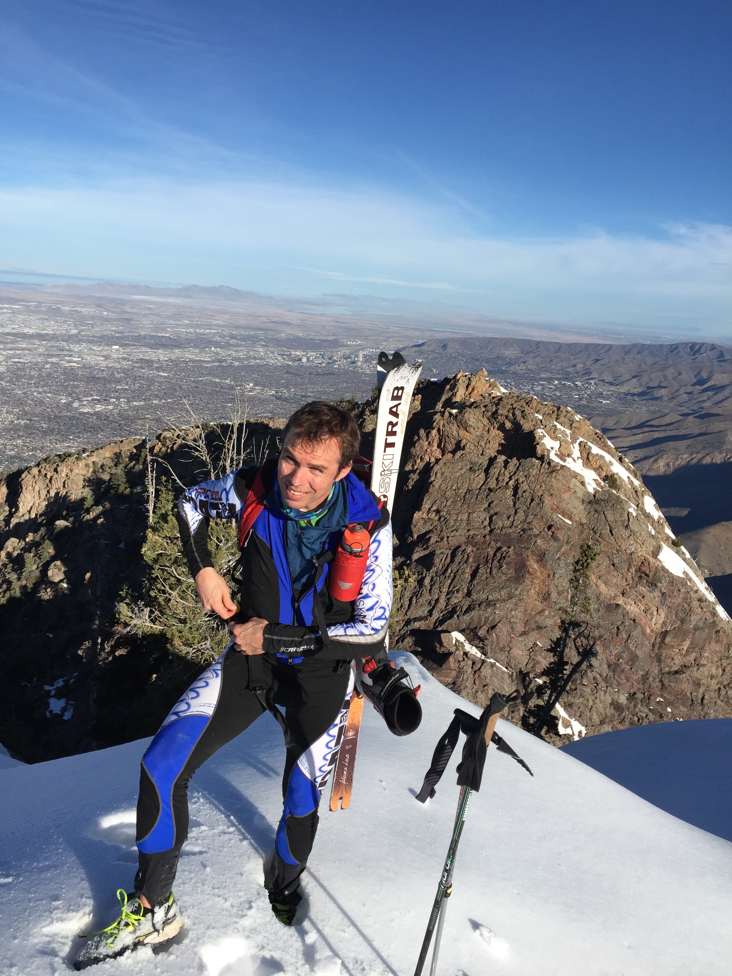
Before I first moved to the Wasatch for the winters, I went on a long adventure with my friend Chris Covington. I say “long” because at the time, it was a long day of backcountry skiing on regular sized ski touring equipment for me. I had gone much further on race skis with a lighter pack in half the time. But this, was different. Like most, I had not explored much out of Little Cottonwood Canyon. The Wasatch still seemed huge and much of the terrain was still unknown to me. Here is a quick synopsis of our adventure. We started at the White Pine trail head- climbed the Pfeifferhorn and skied it’s North West Couloir, rapping the cliff in the middle. We then skied up the head of Hogum Fork up and over Thunder Ridge into Bells Canyon and up Lone Peak. From there we changed into our rock climbing costume, rapped into the Lone Peak Cirque and climbed the Center Thumb out. We changed back into our ski costume and skied a North east Couloir and out Bells Canyon where we hitched back up Little Cottonwood Canyon to complete our big adventure. It took about 12 hours and was likely 15 miles, 7,000′ of climbing and all with a rope and rack on the back. And ya know, I felt tired but great. What else could we do here? Of course I began dreaming up more big adventures and link ups in the Wasatch.
Over the years the adventures keep getting bigger. It’s the normal progression right? Fast forward past four winters in the Wasatch to last weekend.
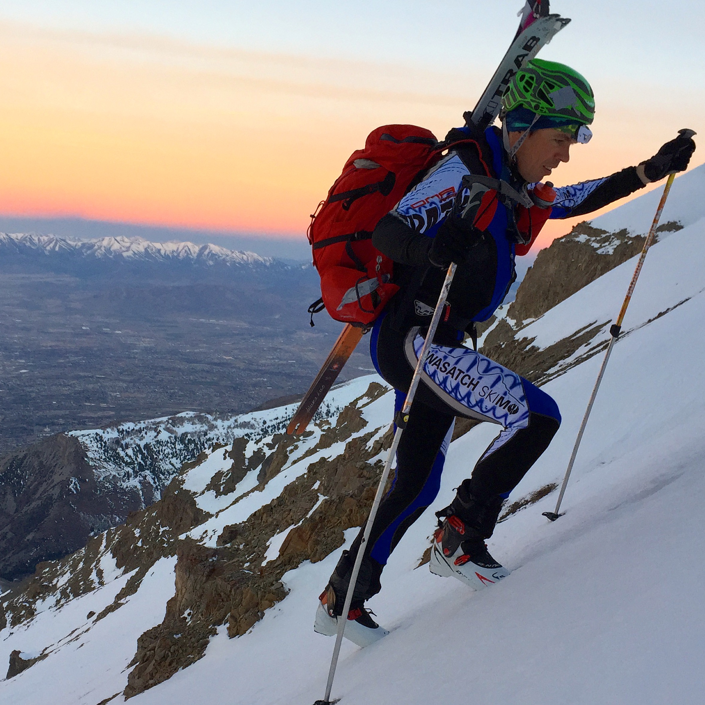
“…yeah Noah Howell skied from Lone Peak to the SLC Twins during his ‘Super Coaster’ “yeah, thats pretty big.” “Timpanogos is a big single run.” “How about we link ski lines on Timp and Box Elder in a Day?” Andy Dorais- “Hmmm, why don’t we ski lines on Timp, Box Elder, The Pfeifferhorn, and the SLC Twins in a day.” It just kept getting more and more absurd. I don’t know who suggested it, probably Tom Goth, “…but why not add Mt Olympus and then its an enchainment of five of the most prominent peaks in Utah and Salt Lake Counties.” So we’ll ski from Mt Timpanogos to Mt Olympus? Why not? I like skiing all day and night!
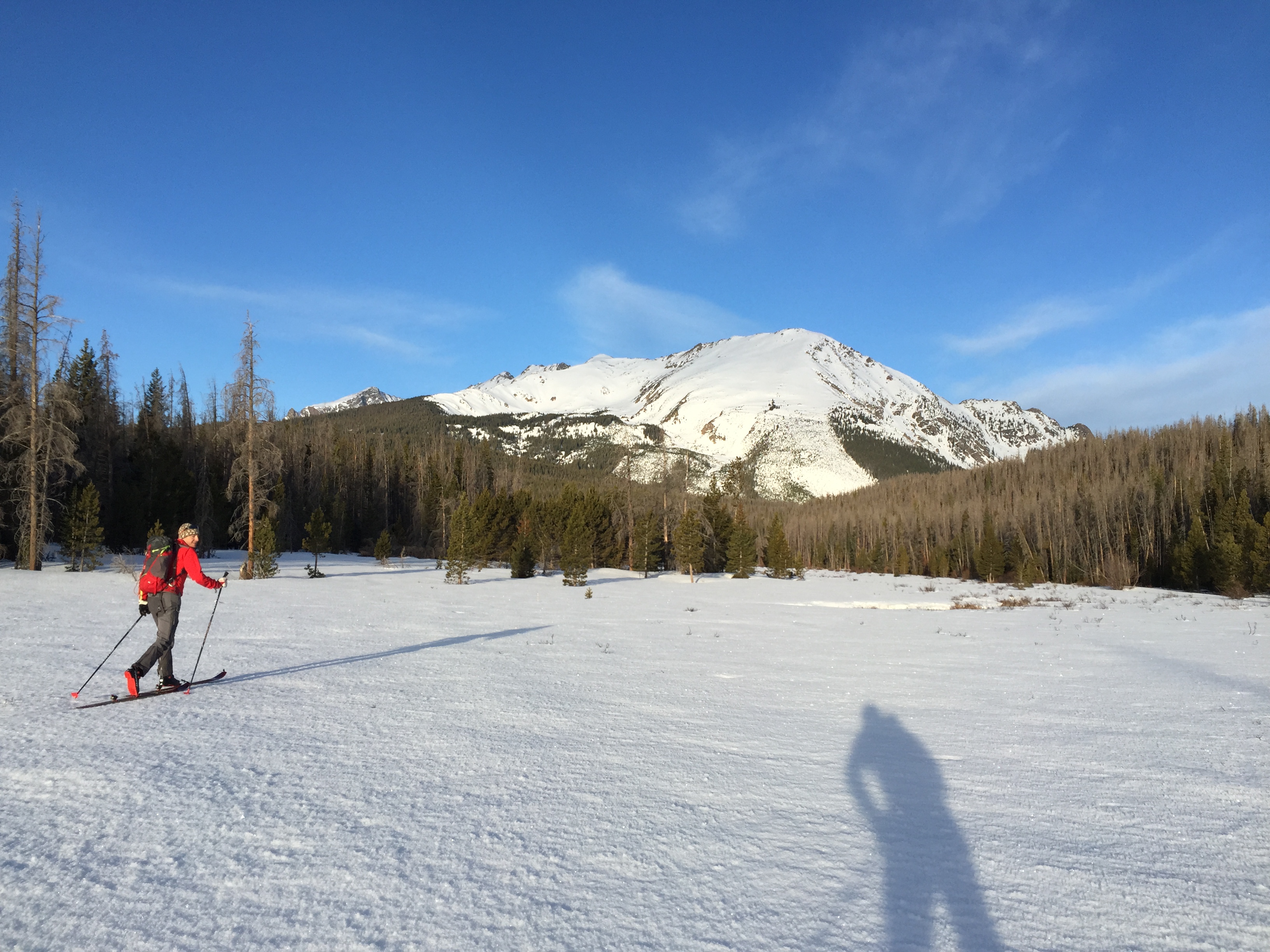
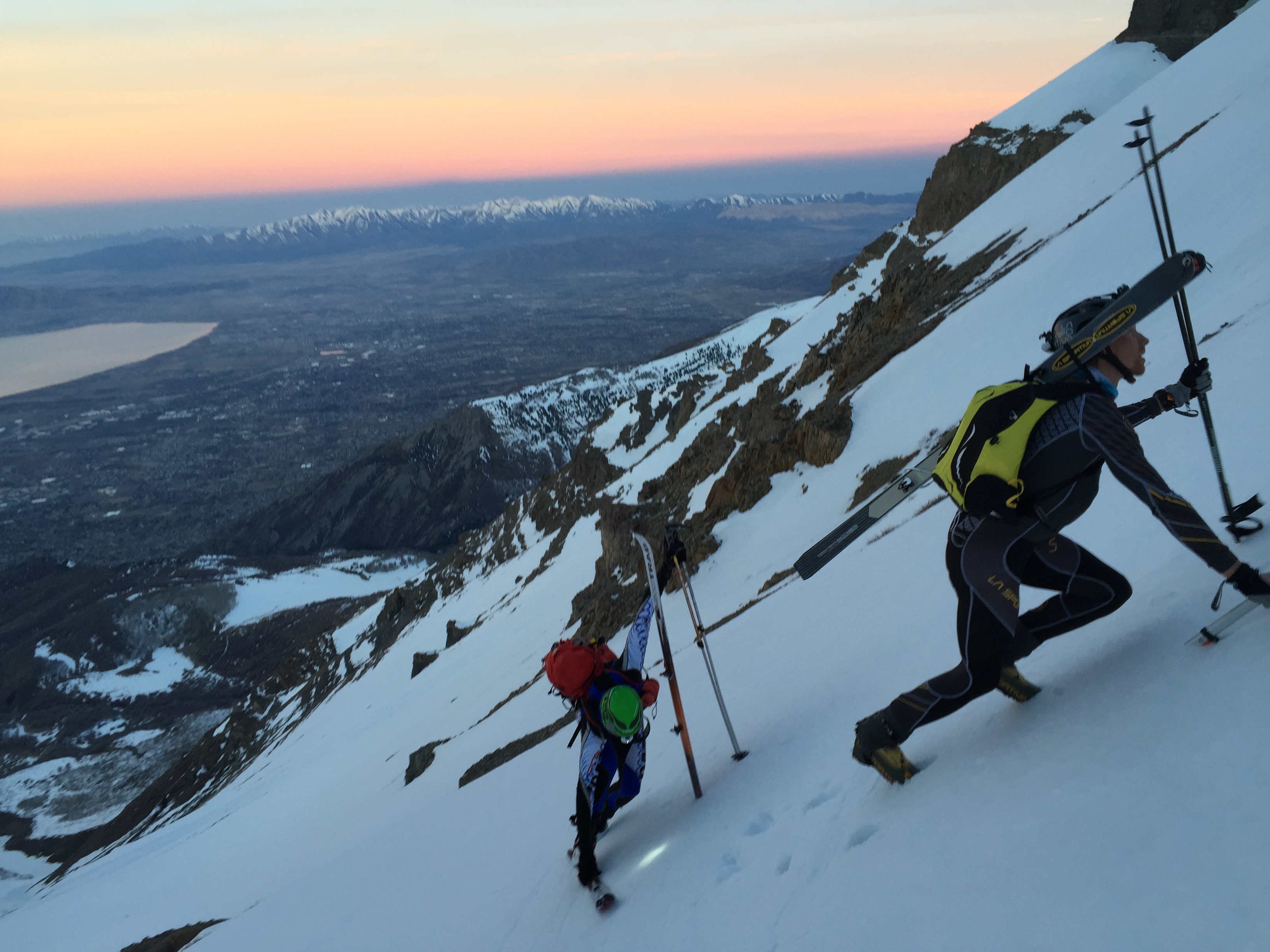
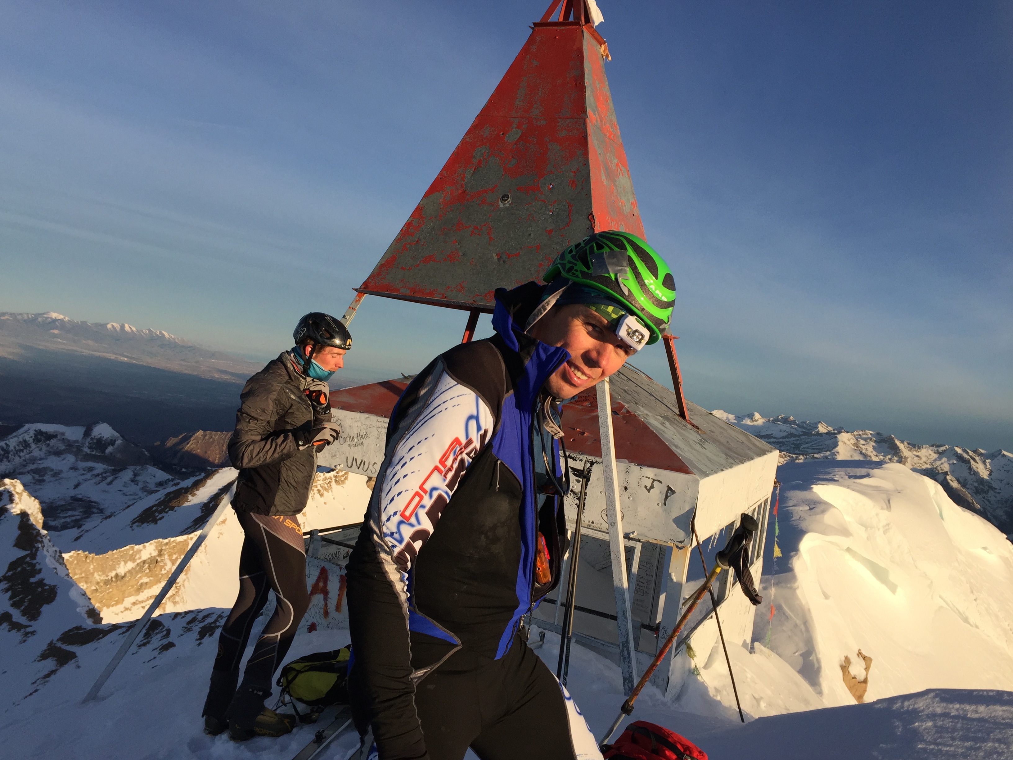
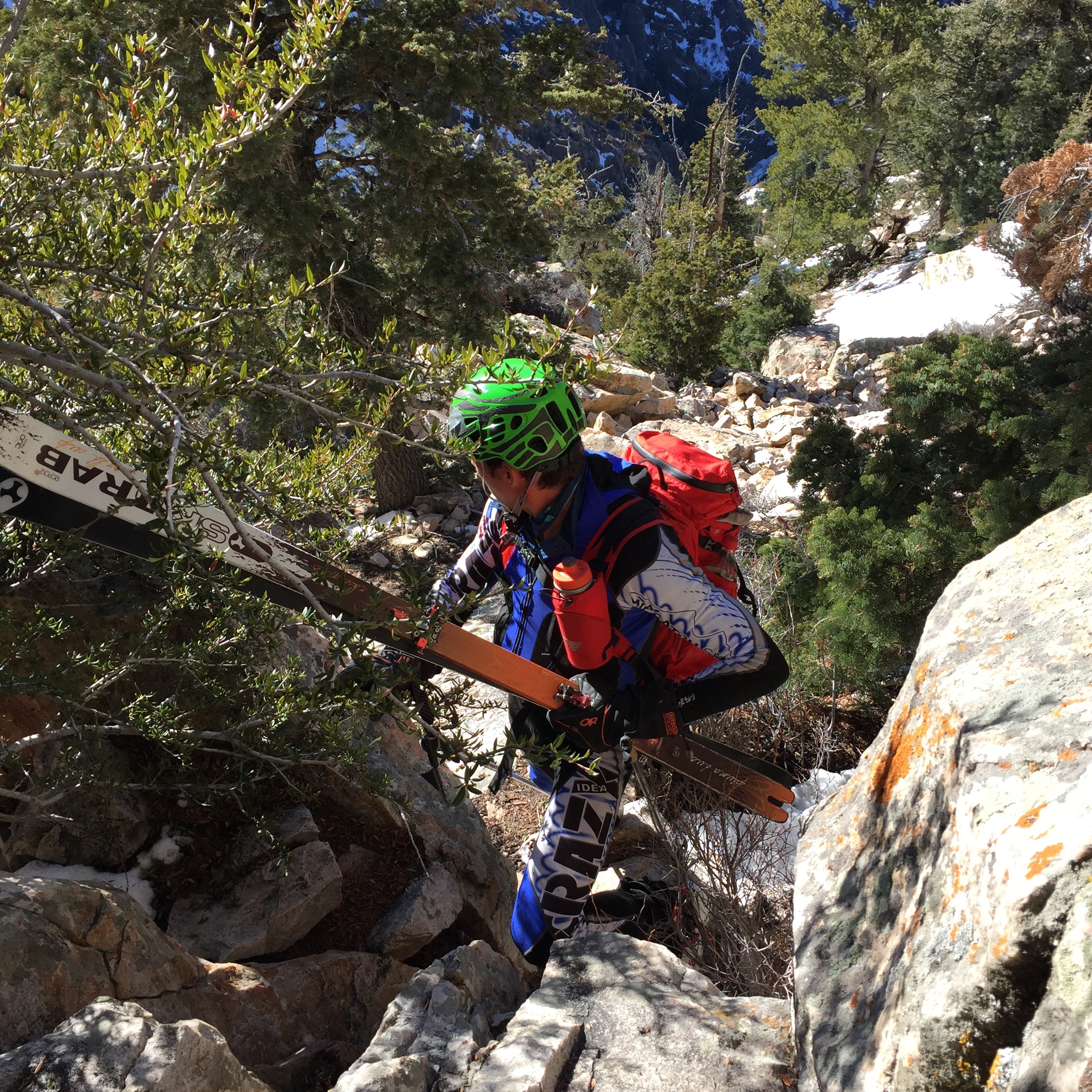
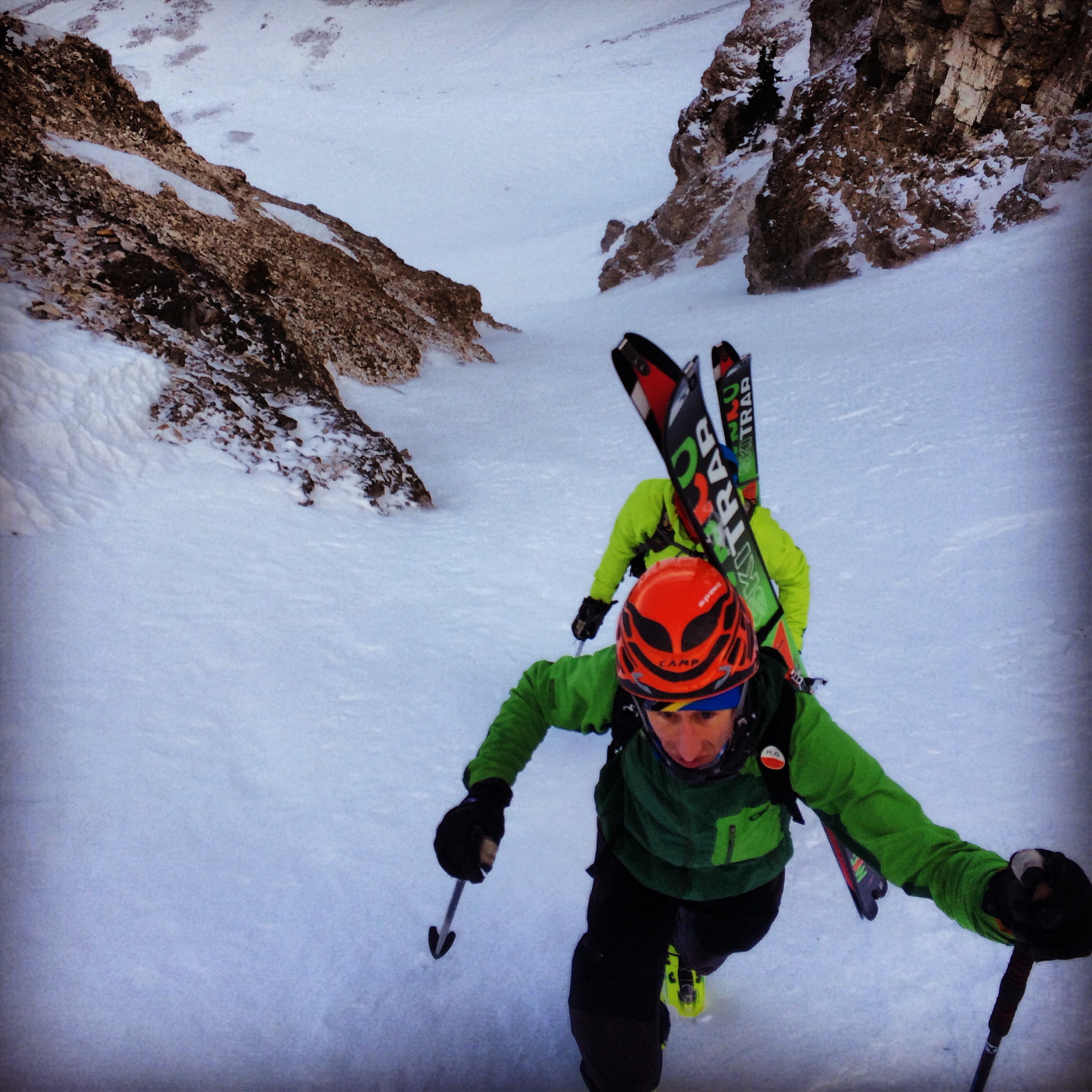
Lars Tom and I made the nearly one hour drive to the Battle Creek trail head in Pleasant Grove. It seemed strange to drive for almost an hour mostly on the interstate only to get out with the intent to ski back home over some of the ranges largest mountains. It was still dark and I wasn’t awake enough to come to my senses before my light Scarpa Tru running shoes were on and we were walking up the dirt trail to the snow. I note ‘light’ since we would be carrying them for the next day and a half. This stretch of dirt was only a couple miles of the 6,500′ ascent and one of the times we gave the middle finger to global warming. We hit the snow at the dead elk caracas and enjoyed fast skinning and good booting to the summit in the rising light.
Lars and Tom saw Mountain Goats near the North summit while I was obliviously walking the rock ridge toward our descent.
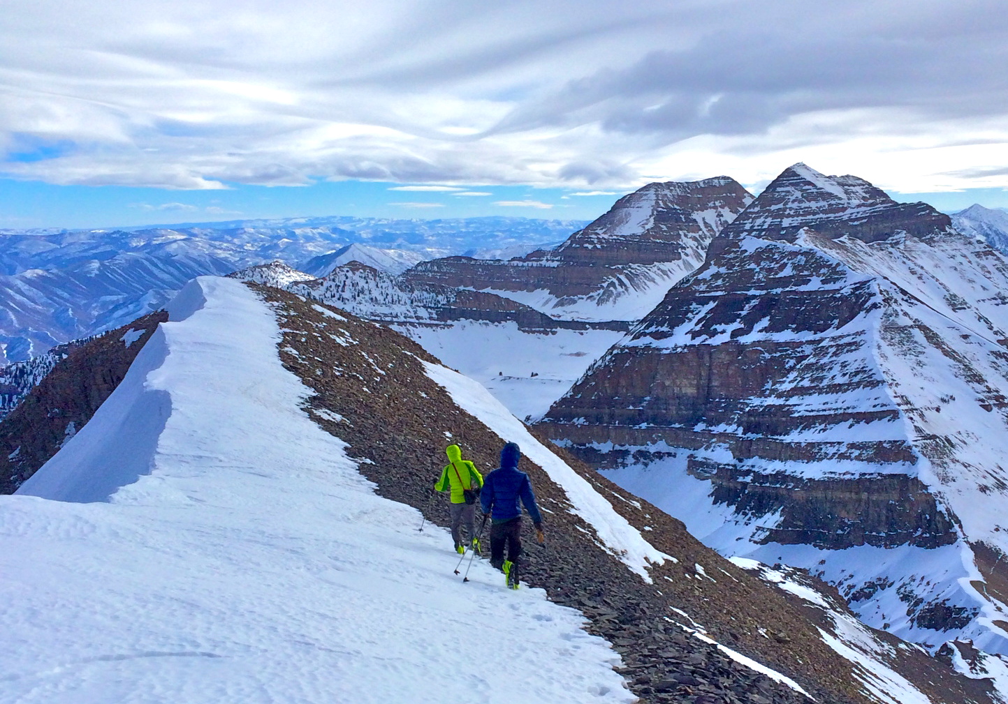
Tom Goth walks the knife edge ridge from the North Summit During the Mt Timpanogos to Mt Olympus Enchainment
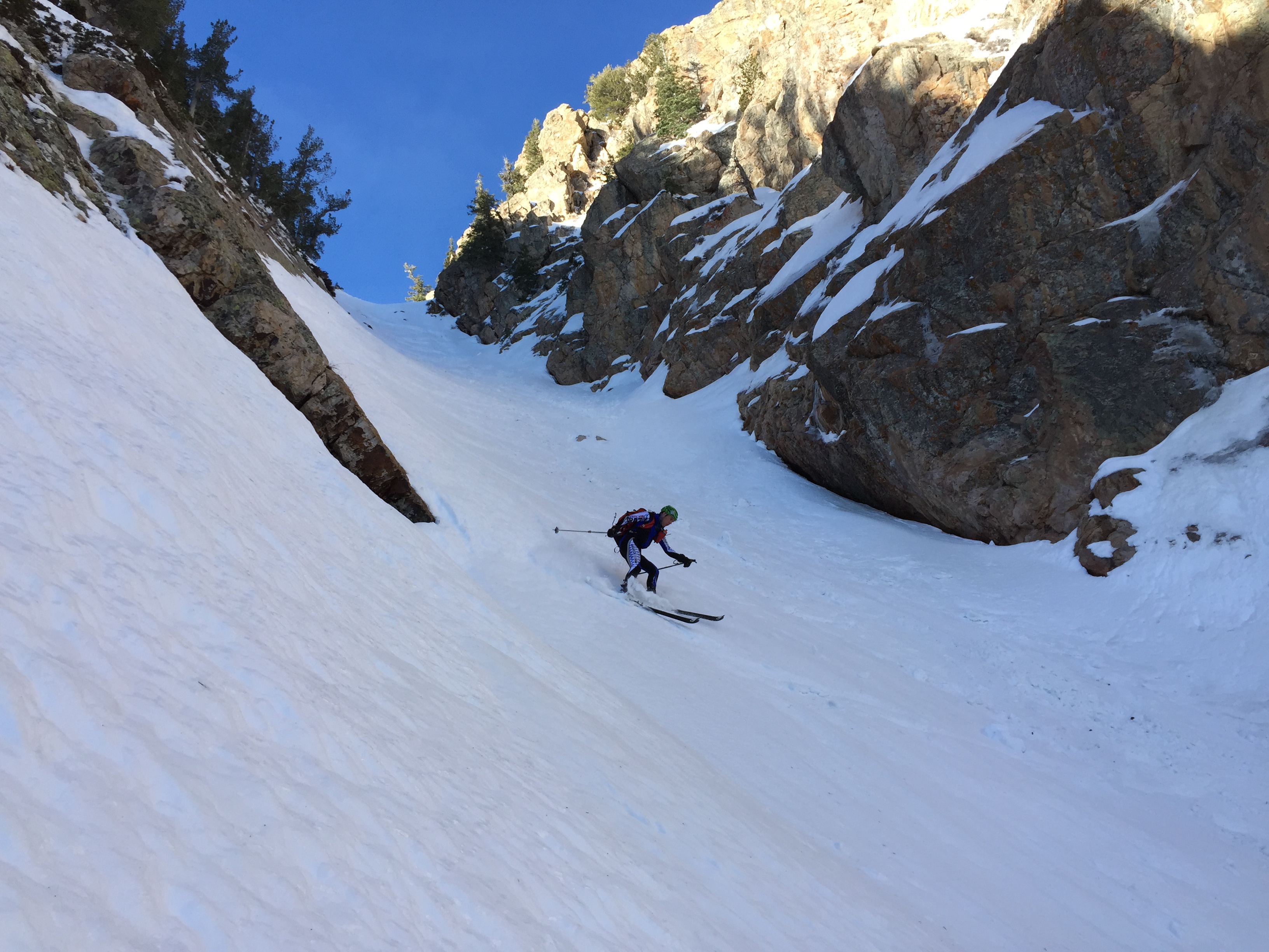
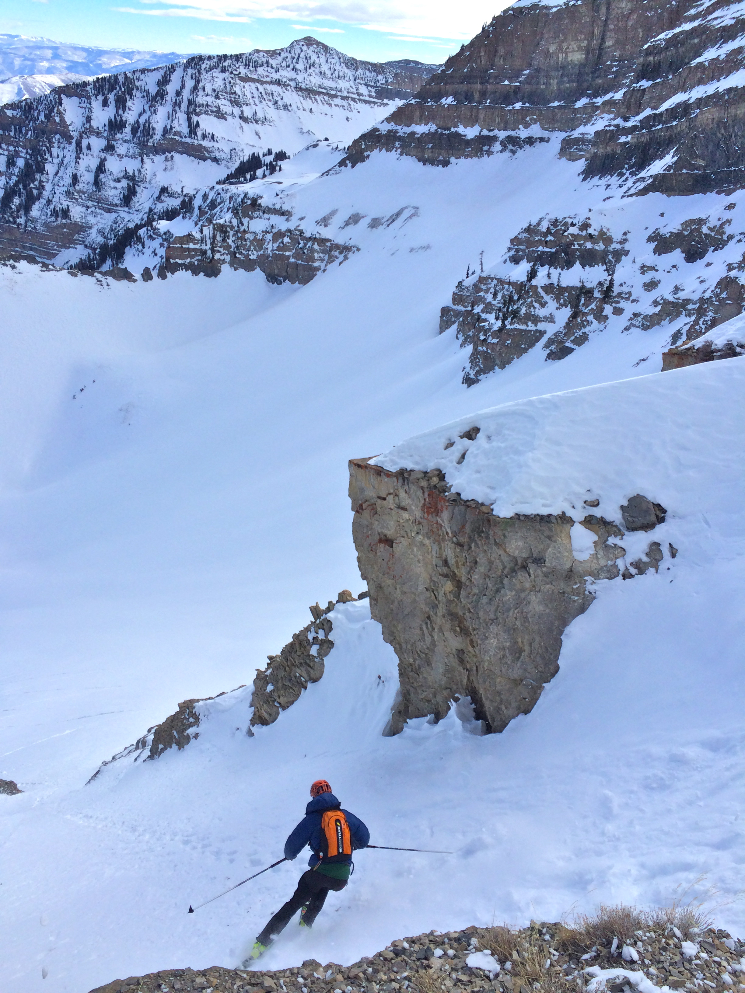
Tom dove in first, opening the 4000′ cold creamy descent into the Timpanookie basin, through snowfields and gladded chutes, down a rad little couloir and out the road until the snow gave up, and spring pavement took over.
Aliens off, shoes back on and down the road we walked. Toms awesome girlfriend Dominique met us to refuel. Bellies full we walked the road up to the Tibble Fork trail head and began our ski up Box Elder. Box Elder took a while during the heat of the day. Luckily Tom had done great route finding homework and kept us right on course as we all alternated taking good pulls to break trail to the summit. Somewhere around the top we hit about 12k of climbing for the day and the legs were beginning to feel the accumulated vert. On the summit we ate and drank well. All three of us know these events are only eating and drinking missions with a lot of skiing thrown in. After skiing some ok snow down to the Shotgun Chutes the day got even better. The Shotguns always seem to deliver cold settled creamy snow many days after a storm. We laughed all the way down the 3000′ line.
-Phone dead no photos from Box through the Pfeiff 🙁
-Phone charged a bit when at aid in LCC Keep reading for more photos!
The climb up the Pfeifferhorn found us breaking trail about half way before we opted to take an existing skin track. We chose to avoid the steeper more direct and solar aspect approach with the hot temps and wet snow. Could be tricky footing and just a couple steep slopes to climb under warm snow. We cruised seemingly effortlessly on a low angled skin track before gaining the ridge and scrambling and booting to the summit. Climbing up the Pfeiff late in the day after an early start and over 15,000′ of skiing, produced a strange feeling . It was like we were suspended in time. As I booted the last steep pitch onto the summit I looked at my feet for careful steps in the icy boot track. When there were no more steps to take me any higher, I looked up and out past Box Elder back to Mt Timpanogos in all it’s grandeur. It looked impossibly far away. I turned to look at the Salt Lake Twins and felt, happy. This, this is where it all makes sense. It all works so well. This is perfect. The boys ripped skins and we dropped the east ridge and into the high North facing headwall of Maybird. We enjoyed a nice 4000′ run of shaded snow all the way down to Red Pine trees and the road below Tanners. Dominique showed up like clockwork with provisions to power us onward. We changed socks, mowed down donuts, pizza Coke and potato chips. Lars had broken a pole while crossing the creek so I attempted to fix it with a coke can, stick and duct tape. Nothing was going to stop us from finishing this thing.
Except maybe Tanners.
Nothing worked very well. We kept switching from post-holing in the mildly crusted iso-thermal snow to slipping while skinning on Avy debris. It was so slow. And then we realized we had followed snow up an east fork about 800′ vert off course. We planned to fork right to avoid the suspected melt out and waterfall of the main drainage but we forked to early. I gained a ridge and turned on the high beam. Yep, way off. The guys were demoralized. We really slowed down, stopped and messed around for to long deciding how to move forward. I figured we could continue and according to the map and memory, ski off and around Dromedary to regain our route up the Twins. It seemed like the conservative thing to do was back track. I hate back tracking. We were now 15hours, and around 17,000′ into the trip. We punched in and stumbled back down through the half frozen avy debris only to turn the corner into the correct fork to re-ascend. It’s now 9:30 at night and we need to punch and slip our way back up at least 2000′ to the top of Tanners. And then we still had the Twins, the Defsmith shwack, Wasatch Boulovard and Mount Olympus to go. Wow. And you know what? I didn’t give a #u$%. This is a small bump in a long road. We finally made it to the top of Tanners in 4 and a half hours including our detour. What normally takes us an hour and a half took three times as long in our state and difficulties. Happily at the O’Sulivan/Dromedary col we ate more food and drink. Throw the lever on the Aliens, rip skins and drop into the dark. Score! We surffed the cold dense powder down the North side high into Broads Fork. We cut left part way down and started up the fourth major peak of the “day” under the stars and calm night air.
At this point Lars started to act pretty sleepy. We all certainly had our moments. Once we met the rock step in the ridge that requires some exposed climbing I suggested he lead as I thought in his sleepy state that leading would cause him to be more on point rather than less engaged while following. We don’t use a rope for this section and the holds are good if you are awake. Plus, he had been there only a few days earlier to ski the South West face of the Twins. I followed as Lars quickly climbed up the rock step and we were booting toward the fourth major summit.
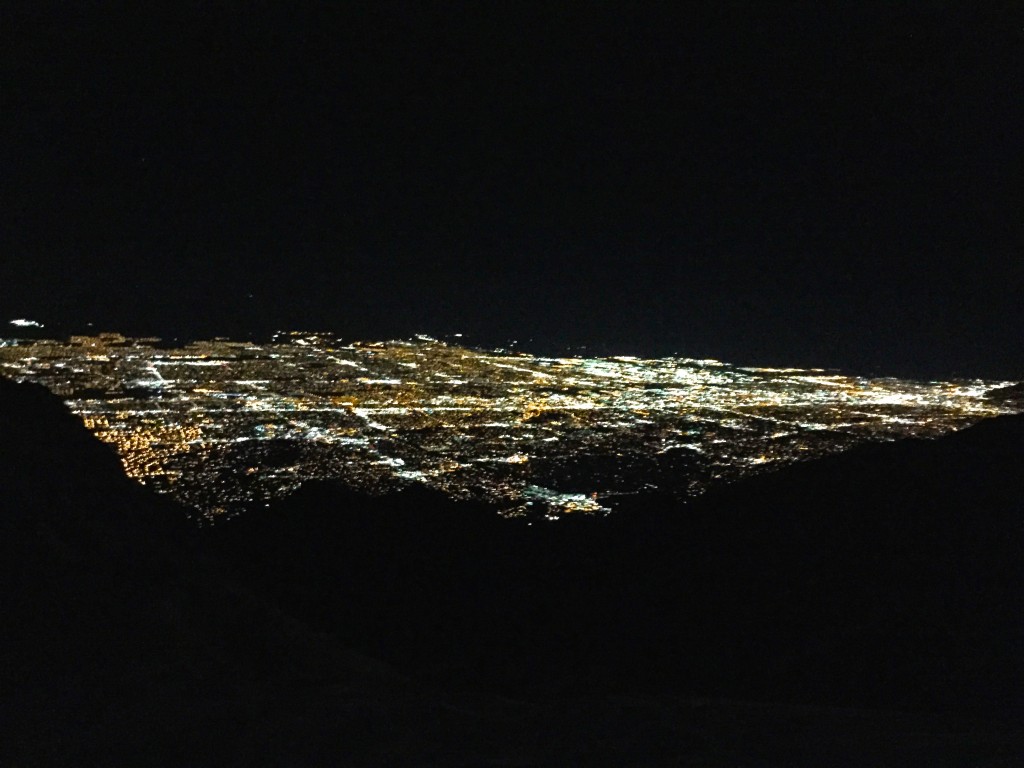
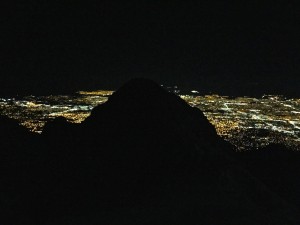
Once we hiked a leg up and pulled onto the summit, the expansive lights of the Salt Lake Valley flooded our eyes. What a sight.
It was 2 in the morning. We skied off into the sustained steep North west Couloir of the most prominent Mountain over the middle of this valley of well over a million. Most of which were sound asleep as one should be at 2AM. This 6000′ line would be a popular classic if it wasn’t for the shwack out Defsmith Canyon. During a regular tour it would be great to ski the top 3000′ and ascend to Bonkers. Or do like Noah Howell and ski the 4 or 5 major lines off the summits of the Twins. Why not?
Let’s not discuss the shwack out of Defsmith. This is one of the parts where we give the middle finger to global warming.
After escaping the grips of Defsmith we strolled over to the 7-11 to refuel. (Dominique was asleep like everyone else but us and the store clerk) He wasn’t sure what to make of our ‘get-up’ and red eyed wandering around the store, pulling pop tarts, chips and eating donuts right off the shelves. After guzzling coffee and Redbull to wash it all down, we staggered down Wasatch in race suits and skis on our backs. I fell asleep three times while walking and almost fell down. Thank god it was dark and everyone was still asleep.
We charged up the Olympus trail, Lars leading with renewed energy from the rising sun, making it to the summit in not much over 2hrs. As we scrambled the rock to the summit I felt a wash of emotion. These are the days. These are the days we feel alive. When we are at our best. Doing what we do well. When it all makes sense and it all works so perfectly. We were tested for 29 hours and were tired and couldn’t be happier. Lars and I looked at each other and felt the same thing. We smiled, put the boots on, and down climbed the bit of rock to the top of Memorial #1.
While walking through Olympus Cove, Lars a winning Ultra runner mentioned The Mt Timpanogos to Mt Olympus was the longest, furthest, and most vert he had ever completed in a push. I agreed. I looked back on my first “big” adventure in the Wasatch. It was far with a climbing adventure built in, a total blast and eye opening to the potential for exploring in the Wasatch. This Timp-olympus Enchainment was an absurd route idea and right in our back yard. It’s a riot to conjure up ridiculous adventures and then go see if you can pull them off. We end up forever changing our perception of what’s possible, and building relationships and memories. I believe it’s the collaborative minds and sequence of mystery, creativity and realization that make this game of adventure so damn fun. Thanks for the stoke Andy, Jason, Lars and Tom.
23,000′ ascent and 23000′ of skiing, 50+Miles??, 5 of the most prominent summits, 2 counties, 1 wrong turn, fantastic snow, horrendous snow, Scarpa Aliens, 6 Kate’ Bars, Gnarly Whey and Boost, 2 Redbulls, a broken ski pole, and two sunrises.
Jason and Andy Dorais and Tom Goth and I seem to share an insatiable appetite for ski mountaineering in a light full throttle style. We seem to to line up mountains and stack ski lines to march through with non stop enthusiasm and group mega stoke! This adventure found us taking brakes cooking and skiing in the dark. We were still able to complete a good sized enchainment and the down time along the way was a bit chilly, and awesome!
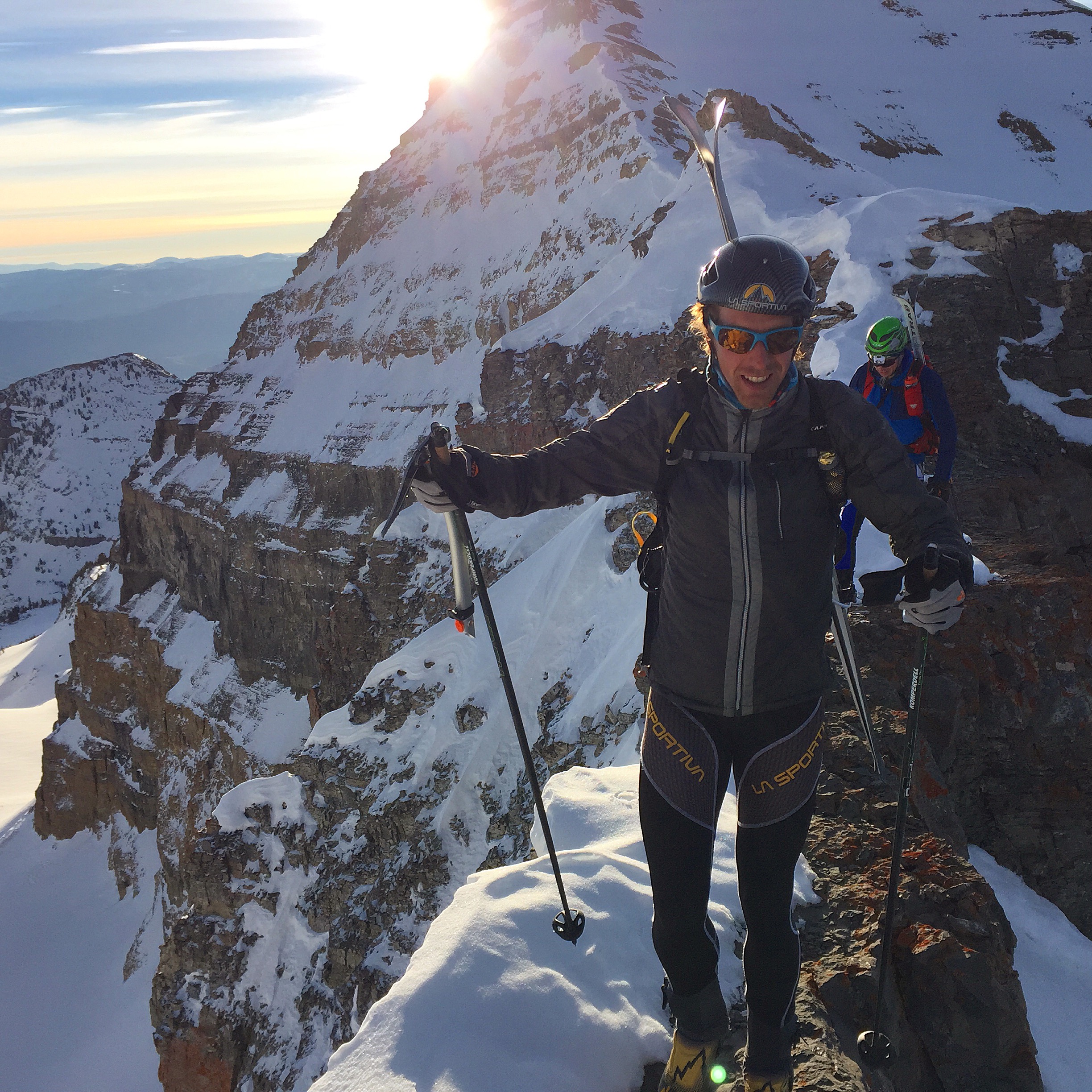
After a mid afternoon start from Salt Lake we drove to the Tagart Lake Trail head. After quickly packing and splitting group climbing gear and a stove we shoved off at about 2:15PM. After shouldering the packs up the South Teton we skied the NW down to the col. The crew of Andy Dorais, Tom Goth and Jason Dorais and I then booted up the South West Couloir of the Middle Teton in the waining low light. From the summit of the Middle Teton we were treated to a stunning sunset. After rapping in from the towering dark summit we clicked in. It was a surreal experience to ski the cold soft snow on the Glacier Route on the East face by starlight. Once we reached the foot of the Grand Teton we took turns manning the stove and napping while we brewed up some food and water and dozing off for a few hours. Well Tom and I manned the stove while Jason and Andy enjoyed their reclined position in our little pseudo biv snow hole. It’s ok, as they pull their share and then some. The Night air ushered us up the Teepee Glacier to the Stettner Couloir up the Ice bulges of the Chevy and on to the Ford where we climbed to our second snow hole to kill some darkness just below the summit rock. So now it’s about 4am and shiver-bivi only lasted an hour or two until Andy jumped up and shouted “I can’t do this any more I’m skiing!” We taped to summit, looked around at the stars since the stunning Grand Teton ariel views were covered in darkness, and skied off into the icy abyss. Sounds moons but it wasn’t bad as we all had skied it a few times prior. I had only skied it once, though it’s the kind of line that becomes forever etched into my mind. It felt so familiar, like an old friend you once feared and now love. While skiing the Ford Couloir in the total dark I closed my eyes to see the views I’ve seen during daylight adventures there. Turns out the feeling of exposure on a steep icy line goes away in the dark. The sun painted these iconic peaks of the Grand Teton National Park while we rappelled the Chevy Couloir. the word ‘grace’ came to mind. How lucky are we, to move through and take in this beauty? Once back on the Teepee Glacier we skated along the glazed ‘never gonna corn up today) surface to the Dike Couloir and out Glacier Gulch and breakfast at the Bunnery in Jackson Hole.
Looking back to the South Teton from the middle at sunset
L
Jason Dorais rapping in on theMiddle
Grace The Middle Teton – Glacier Rt/East Face looking good
Tom Goth dropping into the final apron and some hot ramen and stove duty.The boys digging in for a snow testing ski belay. We found stable conditions though when it’s dark one becomes a bit conservative.Andy Dorais is happy to be cold? and Jason Dorais is trying to pay for his dinner in skins.Down climbing the Stettner Couloir. Some day during a fat winter some lucky skier will ski through the Chevy and Sterner. For now, we are happy to even be there. What a position!The Grand Teton our third summit of the Teton Trifecta The Ford Couloir drops from the East Face Where it ends in a cliff one takes the thin Chevy Couloir to escape to the Stettener visible lower right.
We completed The Teton Trifecta in a long overnight style quite different than our usual light and fast speed touring ways. And it sure was a unique ski mountaineering adventure. Switch up the style and who knows what we’ll experience!
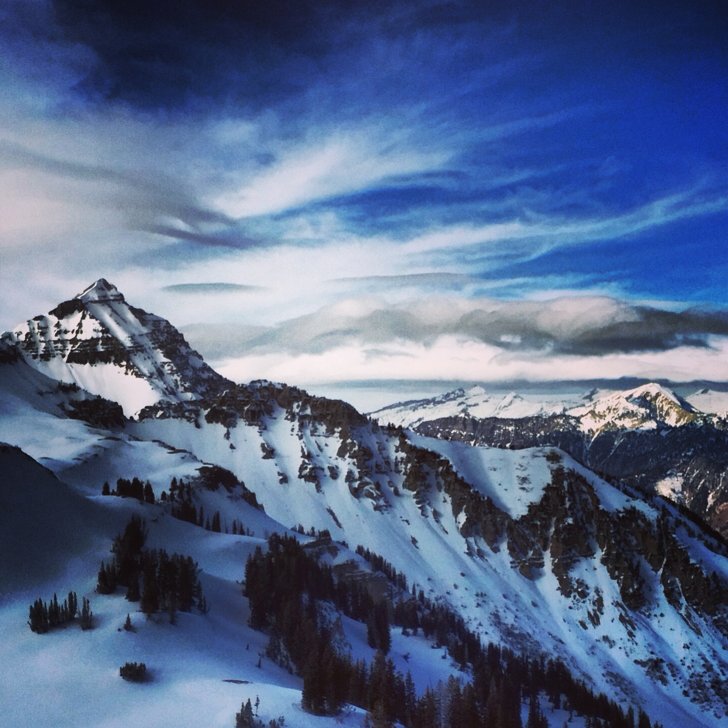
The summit ridge is 17 miles long and it’s flanks rise six thousand feet from the valley. Lot’s of real estate to ski and explore.
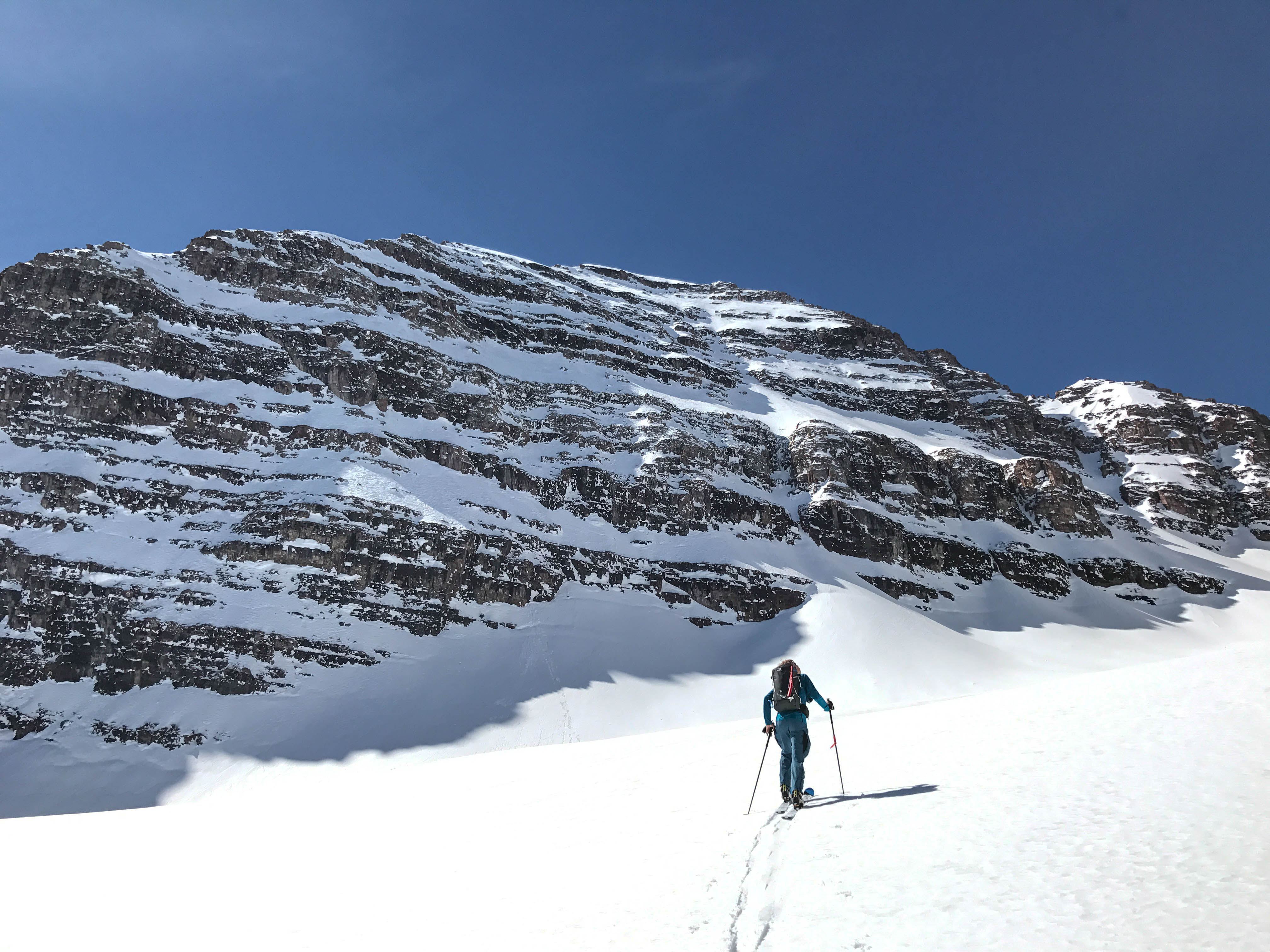
Last January Andy and Jason Dorais and I had been itching to get out there since the snow began falling. We began our ski from the Mutual Dell Trail head and followed the trail up across the Timpanook road. From there we fell into the frequent line rotation we’ve found works so well to move the group while breaking trail. Up Up into the Wooly Hole below the Steep Grunge Couloir. While skiing under it I thought back to my first time skiing on Timp…
January 2012: ‘In Andrew Mclean’s Chuting Gallery he states the Grunge reaches 62 degrees. When I read that I thought no way. I better have a look. Last February I found myself perched on the truly vertical face of the cornice, Black Diamond Cobra ice tool thunked in, tilting my edges up and down trying to find the point at which my edges would grip the, eh hem, ‘very hard snow’ and where my boot would lever the edges free. I messed with this while hopelessly wishing for wider then 73mm skis and staring at the 1000’+ feet of rocky cliffs directly below. Luckily I had chopped a small inset into the cornice to get started from. Today wasn’t the day to ski it from the rim. Skis off, haul myself back up with my tools, Crampons on, back over into the void and climb the 30′ to more edge-able snow and marginally less exposed stance. Yep. It’s in that 60 degree range alright. Not skiing it from the rim ‘on site’ bugs me a bit. Have to go back when the snow is chalky.’
And I’m back. We then continued up a chute into the Pica Cirque and from there wandered up another couloir to the North summit ridge.
The stark reality of two weeks of January high pressure hit us as we stepped on to the west side. It held almost no snow.
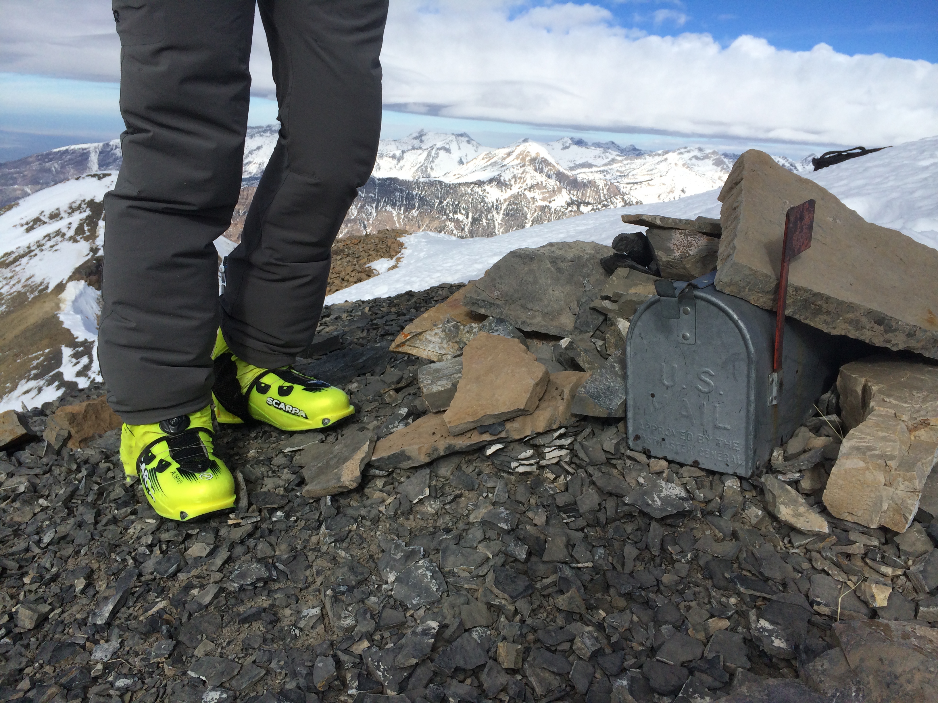
One helluva mail route says Andy Dorais
Jason Dorais and I headed back to drop into Pica Cirque
Thankfully the east side had plenty of snow. So after checking the mail on the North summit box we trail ran down the rocks and clicked in for a great couloir in good cold snow.
From here Jason had to bail for work. We spotted him through his exit couloir and turned em up hill. After rippin’ surrffy facets under The Giants Staircase summer trail, we were feeling pretty psyched. So many folks were whining about ‘no snow’ and ‘another shitty season’ we were linking up cirques and couloirs on the biggest mountain around and loving every minute of it.
Andy and I ascended a well defined couloir up to the Timpanook Basin below the North West side of Roberts Horn. Andy thought the only reason that couloir was well defined is the result of such low snow for the time of season. Bonus couloir! After walking up the Horn we sat on the summit and enjoyed the ominous swirling lenticulars over the Central Wasatch. Our altimeters jumped 100′ while sitting still on the summit. Never a dull moment in the Mountains.
Looking back to our line on the North Summit and the rad cloud show
As the wind picked up we called 9k a good half day and smeared the velvet recycled wind buff out to the road and back to the car.
You know, It’s days like this that I remember. The snow wasn’t deep, nor the sky sunny. In fact the snowpack was relatively ‘fair to shit’. There was an over all malaise in the Utah ski community. But when one is blessed to live in the mountains with motivated friends who are perpetually psyched to get after it, well, then count your blessings. Despite the ‘poor’ snow pack we went out to have a look in a wild place. We found all snow conditions including very good surfy facets and recycled velvet. And we had a damn good time on that Wild Wasatch mountain.